In searching the internet for climate maps that might be useful for educational purposes, I have continued to be disappointed and occasionally dumbfounded. Many highly ranked maps provide outright misinformation. Consider, for example, the two maps posted below, both of which divide the world into climate zones based simply on latitude. As explained in previous posts, this expedient is problematic, although can be useful in certain circumstances. But these two maps make the inexcusable error of labeling the subtropics as “dry climates.” (The two maps might seem to have identical content, but they differ slightly, as the first puts the outer limit of the northern subtropical “dry” zone at 35° N, the most common definition, whereas the second puts it at 37° N.)
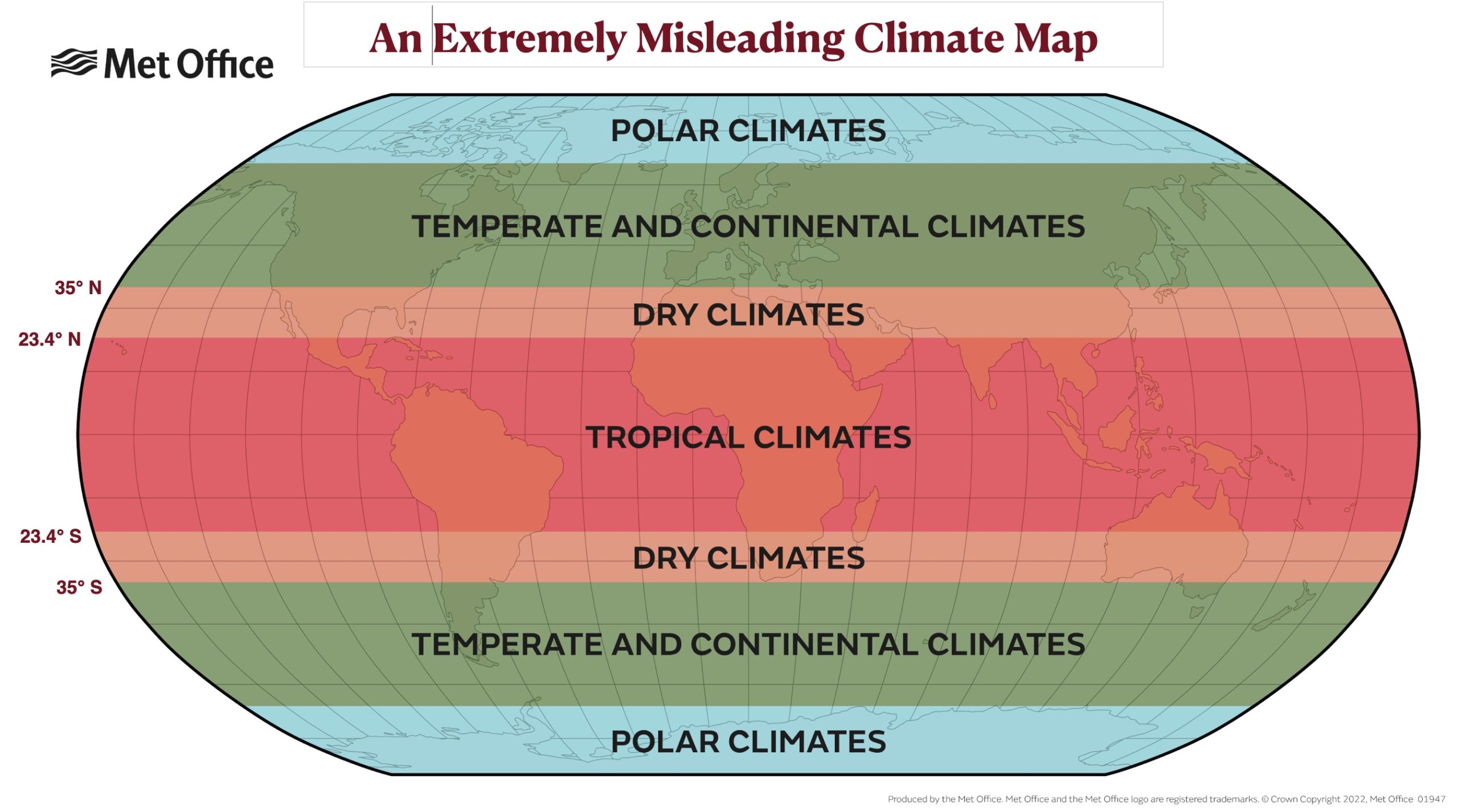
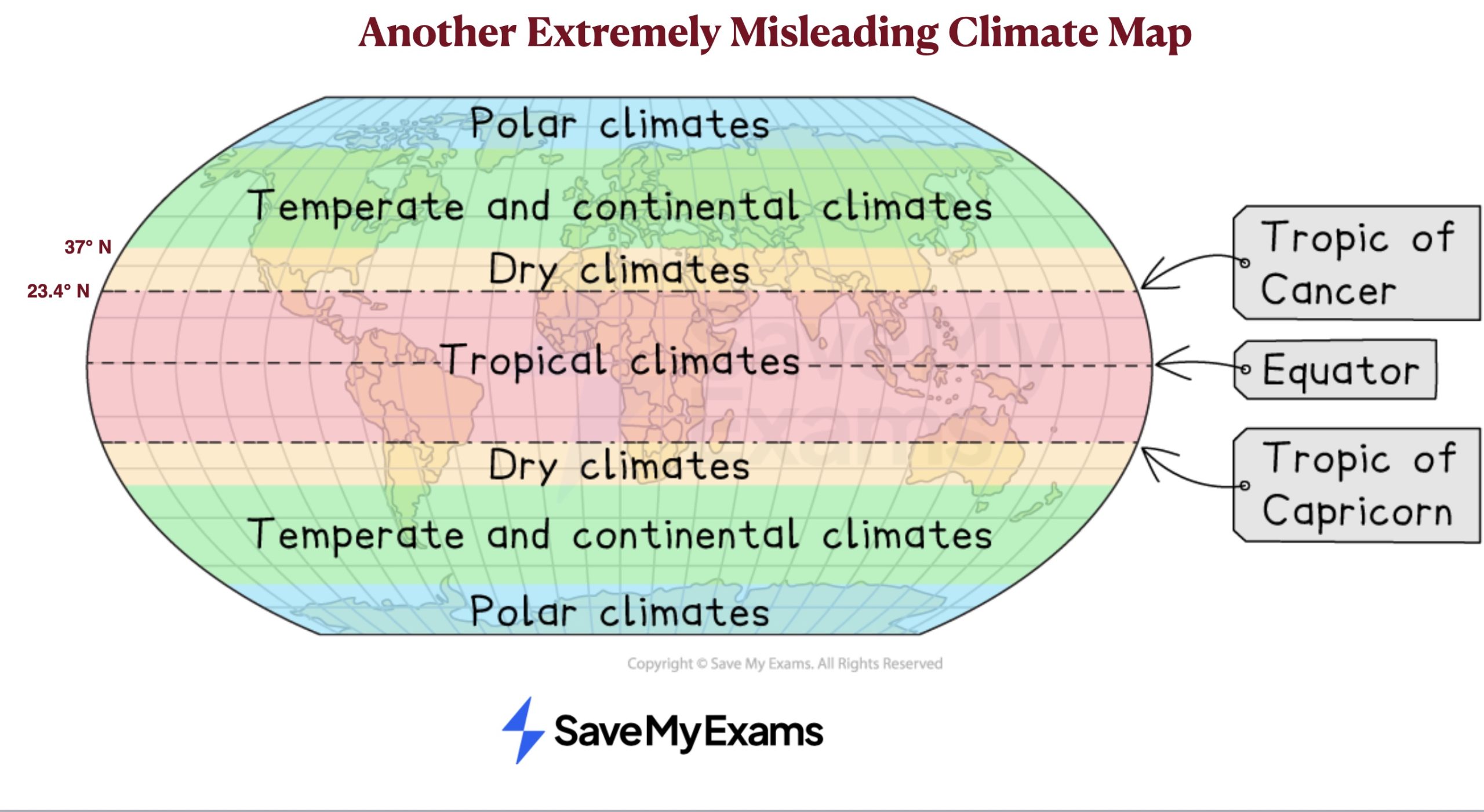
Although the belts of land between 23.4° and 35° north and south of the Equator do contain the world’s most extensive arid areas, and some of its driest ones, they also encompass extensive humid areas, as well as some of the wettest places on Earth. The difference is whether they are located on dry western sides of major landmasses or on the wet eastern sides – with Eurasia and North Africa forming a single landmass, or continent, in climatological terms. This distinction is easily seen on the map posted below, especially in the northern subtropics. As the call-out that I added indicates, the only area in its hyper-wet purple category, with more than 7475 millimeters (294.4 inches) of annual average precipitation, is found in this zone. Although it is almost impossible to see, a small blue area with even more rainfall is located in the same general area (note that the map key is slightly mislabeled, as the “10005” and “394.0” figures should be in the left-hand columns).

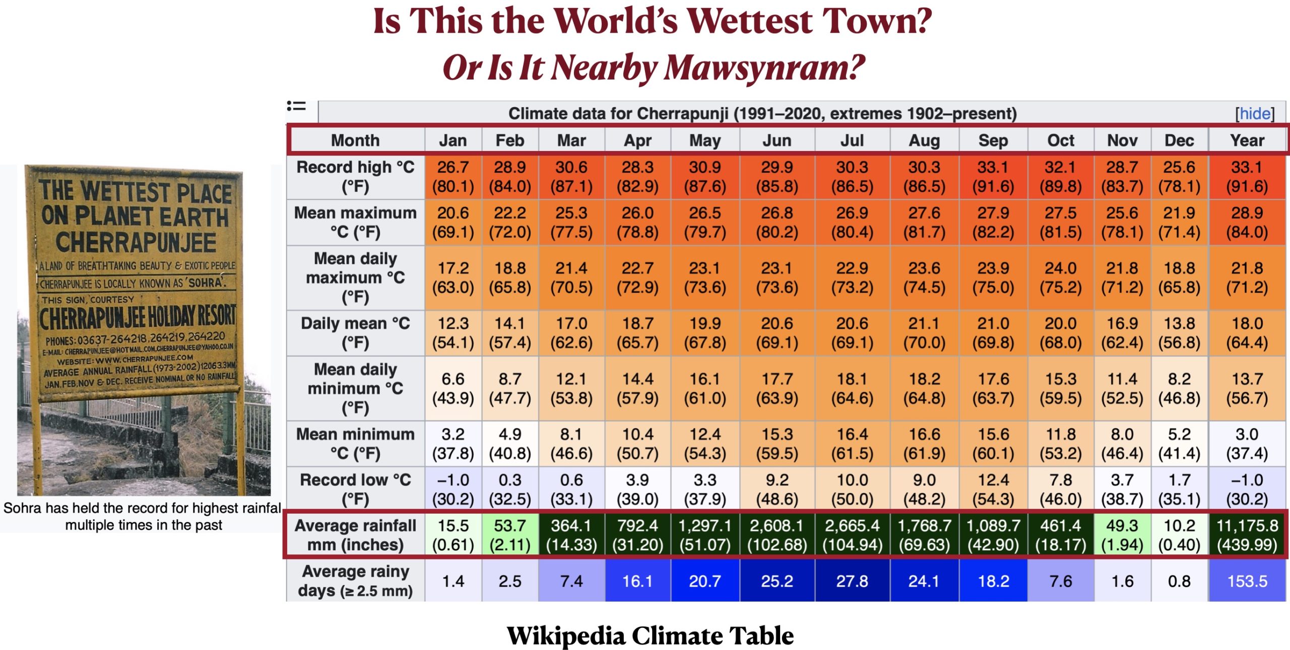
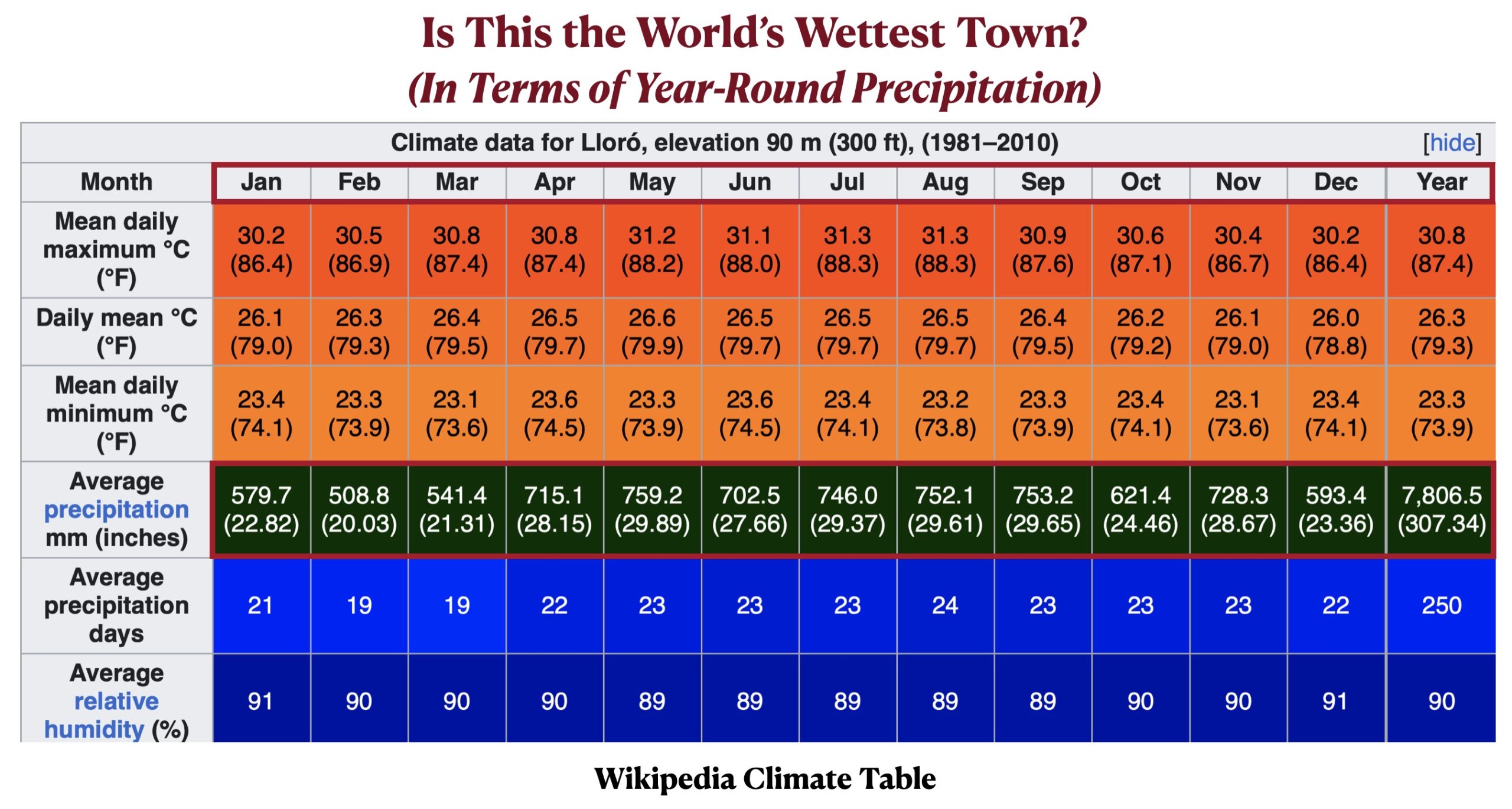
This extremely wet area in a reportedly dry climate zone is the southern part of the small state of Meghalaya in northeastern India. Here the town of Cherrapunji (or Sohra), at 26° N and 4,690 ft (1,430 m), is often regarded as the “wettest place on planet Earth,” although the nearby village of Mawsynram might be even wetter. This title, moreover, is also disputed with Mount Waiʻaleʻale on the island of Kauaʻi in Hawaii and the town of Lloró in northwestern Colombia, as was explained in an old GeoCurrents post. As that post noted, it may be impossible to determine what specific place receives the most annual precipitation. But in terms of reliably heavy precipitation throughout the year over a sizable area, northwestern Colombia does rank in first place.