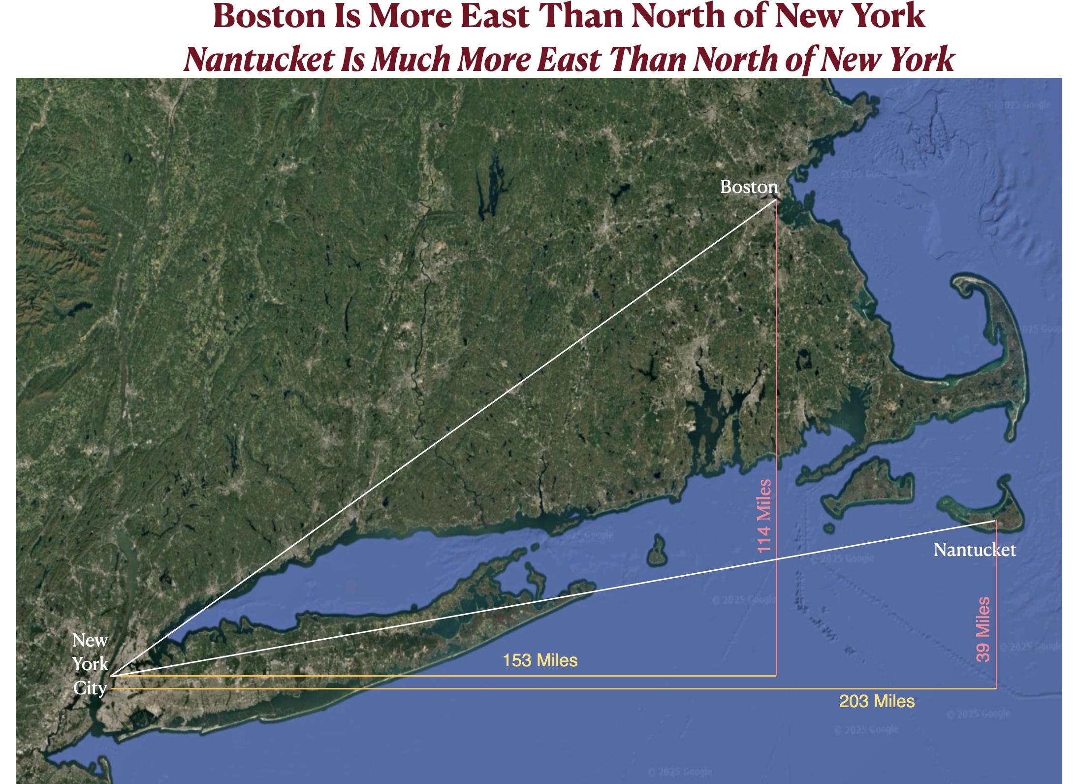
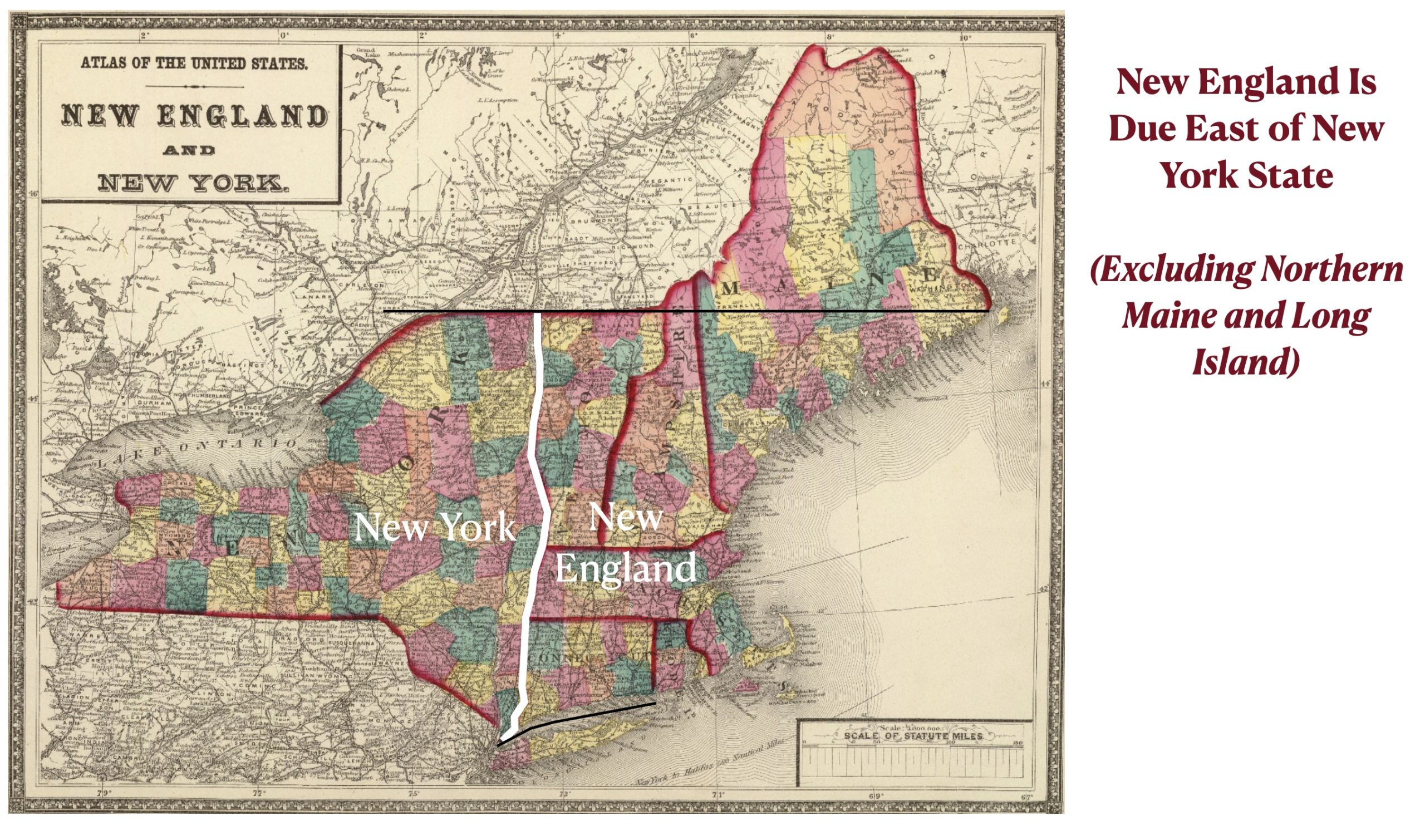
I had decided to move on from exploring the priority of north & south over east & west, but I realized that the most prominent example in the United States had escaped my attention: the northeast coast. Although this coast is often regarded as mostly oriented in a north/south direction, its actual orientation in more east to west. Boston, for example, is 114 miles north of New York City but 153 miles to its east. The situation is southeastern Massachusetts is more extreme. The town of Nantucket, for example, is 203 miles east of New York City but only 39 miles to its north. From New York to Cape Cod, the coastline runs almost west to east. Countering common expectations, moreover, New England is not north of New York state. If one excludes sparsely populated northern Maine and insular Long Island, New England is essentially due east of New York. While I imagine that this fact is widely understood locally, I have a strong suspicion that most Americans would find it surprising.
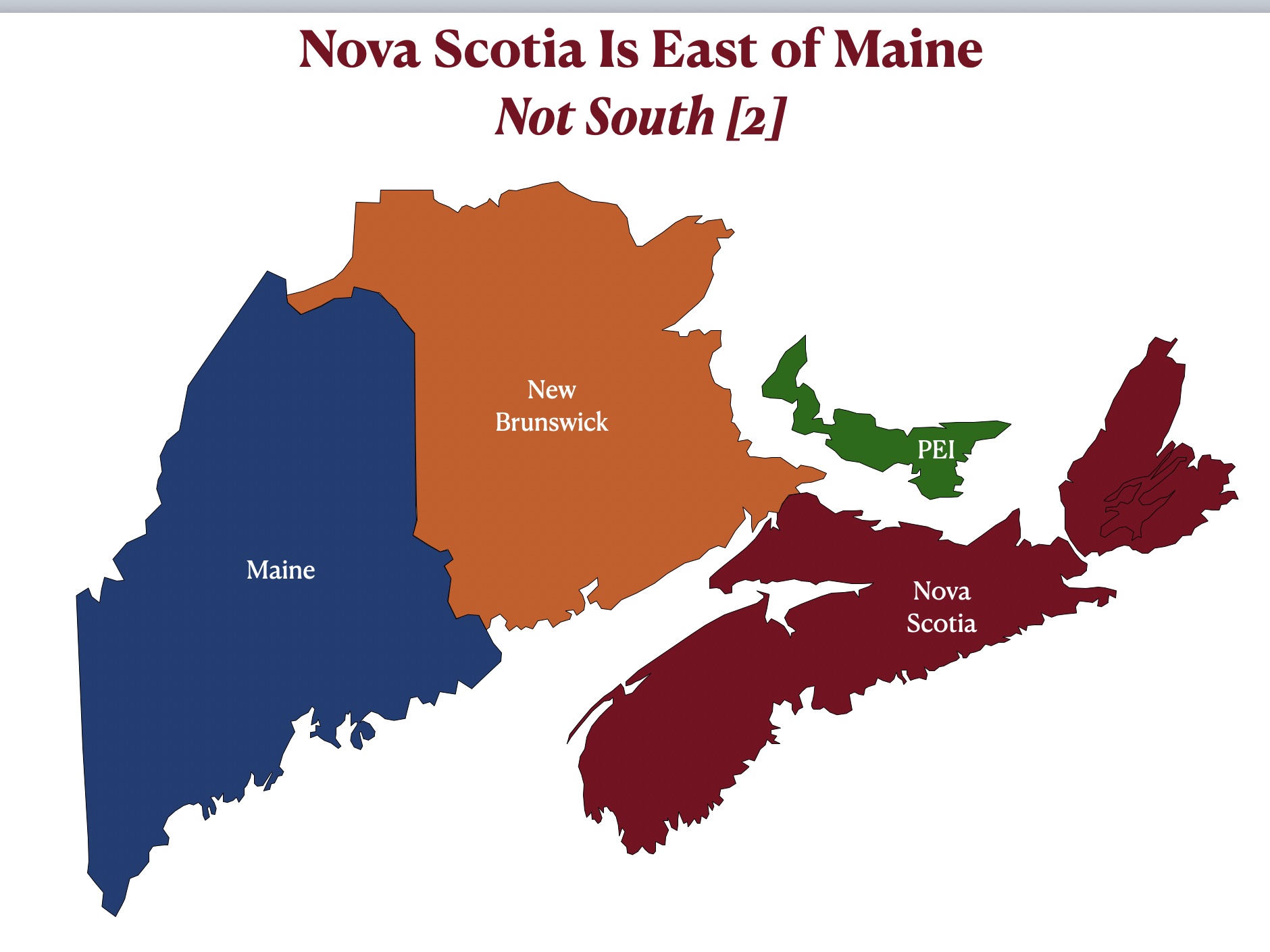
The misperception of Atlantic coastal orientation is heightened if one examines southeastern Canada together with northeastern U.S. together with. To the extent that Americans know about Nova Scotia, I think that it is safe to assume that most of them regard this Canadian province as located north of Maine. Actually, as can be seen in the map posted below, Nova Scotia is essentially due east of Maine. If this map appears to have misplaced these polities, examine the two maps posted below it, which reveal the larger regional context (and show how I made the first map).


This east-northeast coastal orientation extends as far as the island of Newfoundland. As can be seen on the map posted below, St. John’s is only 473 miles north of New York but 1,055 miles to its east. It is also much closer to London (2,285 miles) than it is to Vancouver (3,125 miles).

Because of its eastern location, Newfoundland was once a key refueling location for trans-Atlantic aviation. In the 1940s, Gander International Airport, 124 miles northeast of St. John’s, was one of the busiest airports in the world. Undermined by direct trans-Atlantic flights and far from any cities, Gander lost most of its traffic and now faces, according to Wikipedia, a “grim” future. The St. John’s airport, or Torbay as it is commonly called, has fared much better. According to one (overly?) optimistic local media outlet:
[Newfoundland’s] airports continue to serve as vital links for passengers, cargo, and emergency services, ensuring that the province remains well-connected to the rest of the world. As technology and travel continue to advance, Newfoundland’s skies will remain as busy as ever, carrying on its legacy as the gateway to North America.
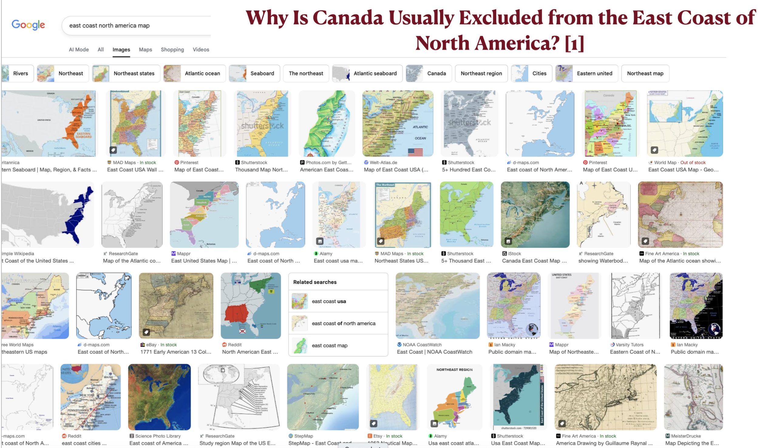
As a final note, I suspect that misunderstandings of the directional orientation of the eastern coast of North America stem not just from perceptual issues also from geopolitical considerations reflected in mapping conventions. Maps made in the U.S. usually terminate at the border, with relatively few showing the geographical relationship between the northeast United States and southeast Canada. As can be seen in the figures posted below, image searches for “east coast North America map” mostly return maps limited to the east coast of the United States. Most that include southeastern Canada, moreover, are simple outline maps with little content. We deserve better.