Learning the cardinal directions is an important but often neglected aspect of early geographical education. It is my impression that the understanding of cardinal directions, like most other aspects of geography, is in sharp decline. There are several reasons for this regression, but surely one of the most important is the abandonment of map navigation in favor of following simple right-left instructions generated by automated mapping programs. If we are to revitalize geographical education, we should teach students about the cardinal directions at an early age.
It is usually best to begin such teaching at the local scale and then gradually expand the coverage. Start by giving young students a neighborhood map and then ask them to plot several courses to a familiar destination. Those courses can then be taken on foot while paying careful attention to the cardinal directions that one is following.
Obtaining maps at the appropriate scale can be a problem. My solution is to take a screenshot from Google Maps or Apple Maps, drop it into a presentation program like PowerPoint or Keynote, outline and highlight the features that I want to emphasize, and then delete the original map fragment. That may seem like a lot of work, but it is easily accomplished. An example that I made for my five-year-old granddaughter, with her own house in blue, is posted below. With this map in hand, we can walk to her friend’s houses, tracing our paths and noting the directions that we take. A compass can be used to verify these directions. I can also ask her to figure out what the colors and shapes on the map indicate (black for the main access road, dark grey for neighborhood streets, light grey for walking/biking paths, green for grassy areas, and polygons for houses and garages). In such a way, children can gain a deep understanding of both cardinal directions and mapping conventions.

More formal lessons on the cardinal directions can be conducted by observing the course of the sun over the day and marking its changing directions with a shadow-stick. A shadow-stick is simply a vertical pole fixed in the ground in a flat, sunny location. The spring and fall equinoxes are the ideal dates for such a lesson. If students can awaken early enough, they can observe the sun rising directly to the east, noting this direction on a neighborhood map. In the early morning, the shadow will be much longer than the pole and will point to the west, away from the sun. As the morning progresses, the shadow will swing toward the north and gradually shorten as the sun climbs. At midday, the shadow will point directly north, away from the sun. Over the afternoon, students can observe the shadow again lengthening but now swinging to the east. If the horizon is directly visible, they can see that when sunset approaches and is finally reached, the shadow becomes so long that it seemingly stretches to infinity and vanishes. Through such a lesson, both cardinal directions and sun angles can be explained and visualized.
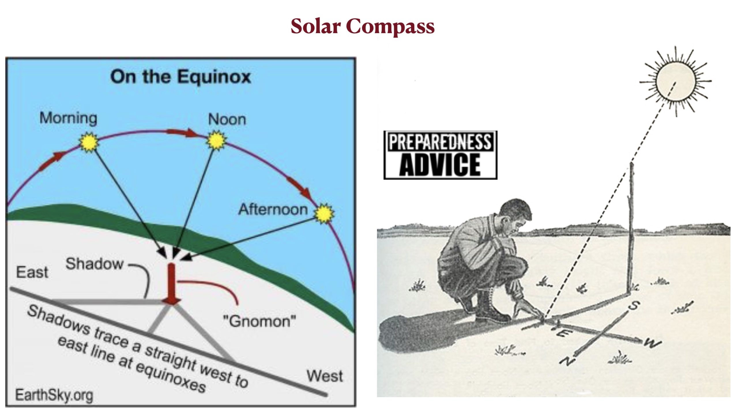
As a more advanced lesson, students can be asked to use a shadow-stick to create a sun compass, which also functions most effectively on the equinoxes. At any time of the day, a rock or another vertical stick can be placed on the ground to mark where the shadow ends. After waiting some 20 minutes, another marker can be placed at the end of the shadow’s new position. After this process has been repeated a few times, another straight stick can be placed on the ground across these markers, which will indicate the east/west axis. Another stick perpendicular to the first will then indicate north and south. Many instructive YouTube videos on sun compasses are readily accessible.
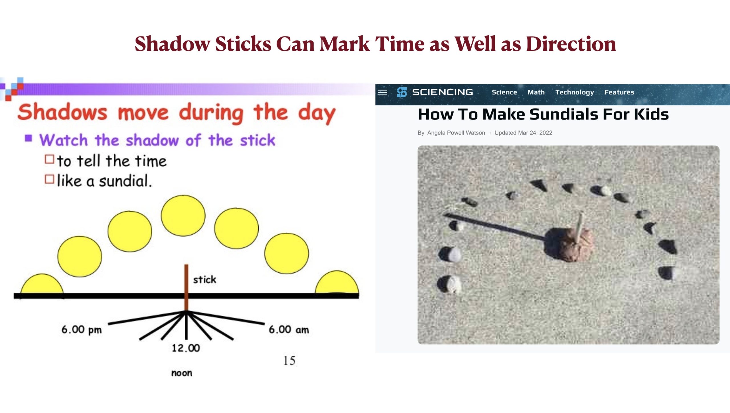
The changing direction of the stick’s shadow over the course of the day can also be used to indicate time, although in a crude manner. Actual sundials are intricate devices, which are best covered at the secondary-school level. But a simple sundial of the sort illustrated below is still useful, especially on the equinoxes. It is also helpful for introducing the concept of longitude, which is to a significant extent a matter of time, as will be explored in the next few GeoCurrents posts.
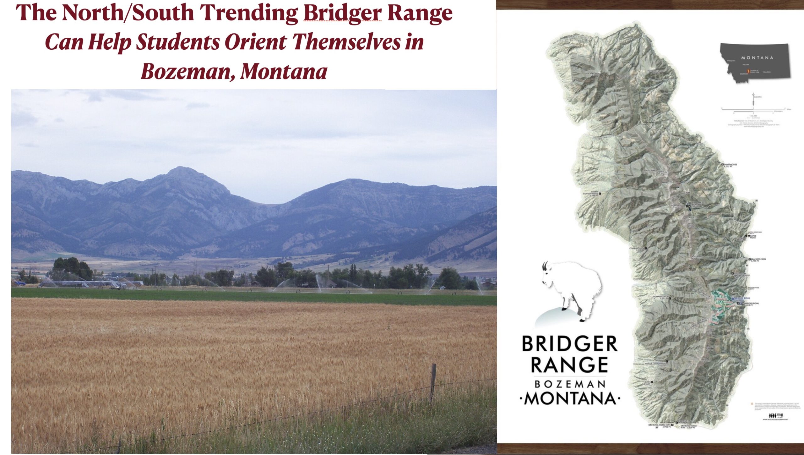
Finally, in some areas local topography can be very useful for familiarizing young students with the cardinal directions. In the vicinity of Bozeman, Montana, for example, the prominent north/south trending Bridger Range is visible in most places, helping students orient themselves and visualize directions.