People vary greatly in their ability to orient themselves by the cardinal direction. But even those with a good sense of direction tend to get confused in certain places. In my experience, Stanford University is a particularly bad place for direction perception. I never use cardinal directions when describing locations or giving directions on campus, as doing so tends to generate confusion.
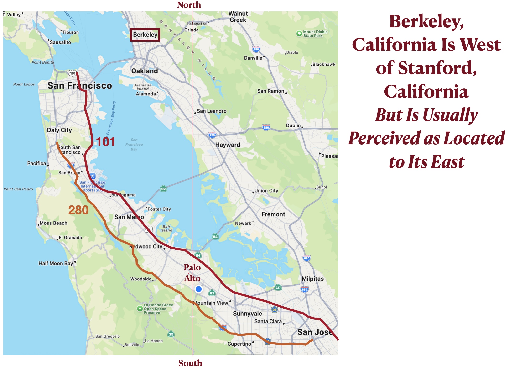
Several factors contribute to these difficulties in direction perception on the Stanford campus. The problem begins with the general northwest/southeast orientation of local landforms, which is often perceived to run instead from north to south (see the previous post). As a result, most* people in Stanford are surprised to learn that the east bay city of Berkeley, home of the main rival school, is located to the west of Palo Alto, which is on the west side of the San Francisco Bay. The eastward swing in this topographic orientation as one moves to the south exacerbates the problem. Consider, for example, the two freeways, U.S. Route 101 and Interstate 280, that run between San Francisco and San Jose, providing access to Stanford and the nearby town of Palo Alto. The general southward directions of these roads veer well to the east in several locations. Between Cupertino and San Jose, Interstate 280 essentially runs east/west. But as is difficult to make mental adjustments as directions shifts, many people perceive these highways as retaining their north/south orientations.
This same issue characterizes the Santa Cruz Mountains, located between the southern Bay Area and the Pacific Ocean. Near Stanford, the range is oriented from northwest to southeast. If one could drive directly west from the campus, one would cross the mountains and soon reach the coast. But to the south, both the Santa Cruz Range and the coastline swing to the east. As this change tends to escape perception, the city of Santa Cruz is usually thought to be southwest of Stanford, although it is actually located to the southeast.

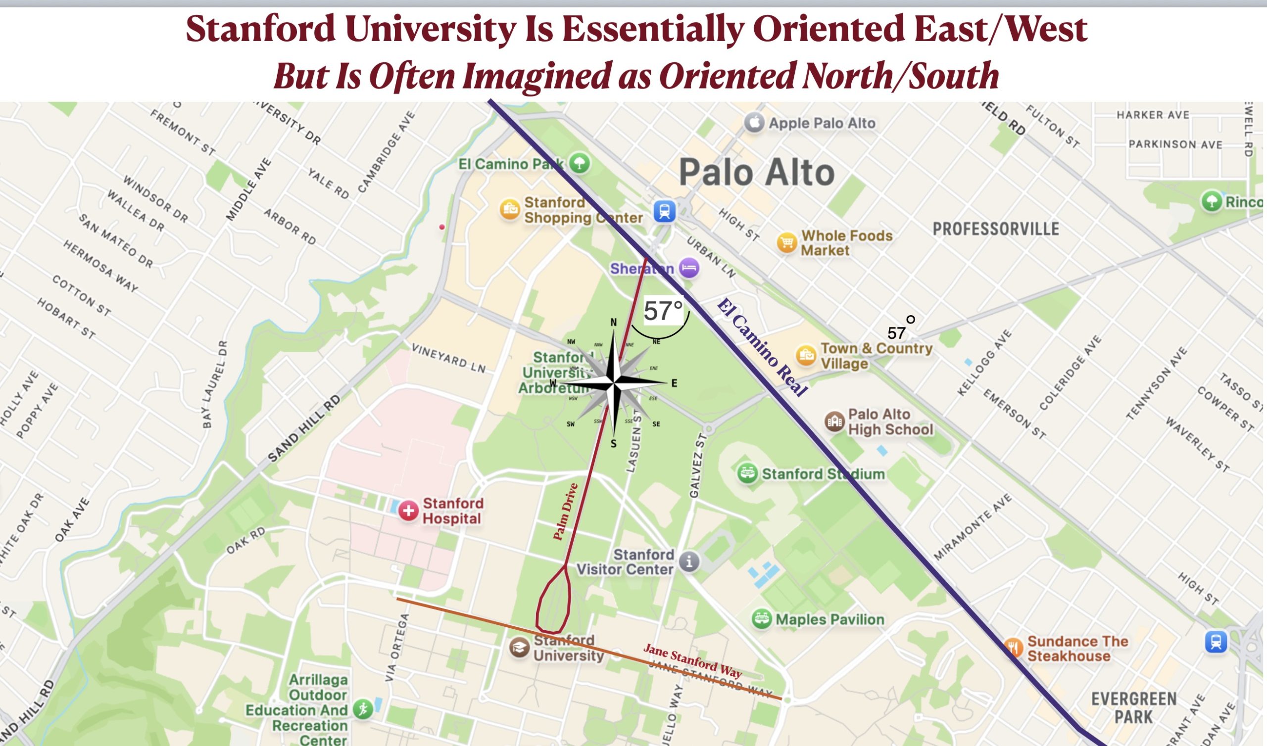
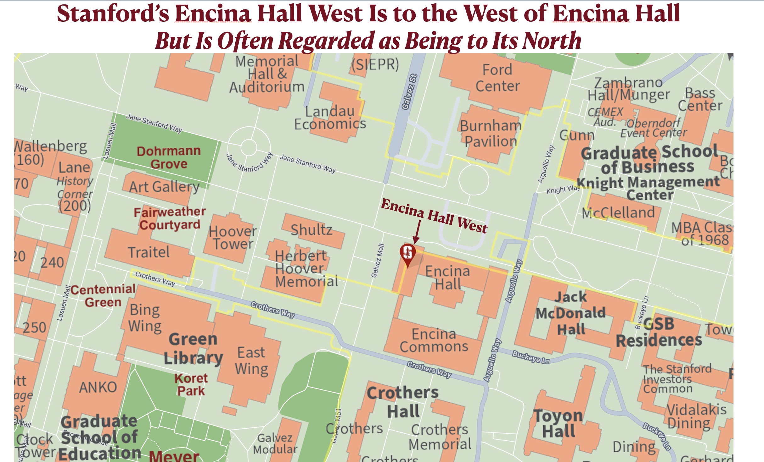
Local road angles contribute to the directional confusion. Most visitors to the campus take Palm Drive, which begins at the storied road called El Camino Real (“the King’s Highway”). Palm Drive is often perceived as perpendicular El Camino, but actually intersects it at a 57° degree angle. Because northwest/southeast oriented El Camino is commonly regarded as running north to south, Palm Drive, perceptually perpendicular to it, is often regarded as running from east to west. But as can be seen on the map posted below, when one enters the Stanford campus on this palm-lined street, one is actually heading slightly to the south of south-southwest. Stanford’s central campus maintains this same orientation. Jane Stanford Way, perpendicular to Palm Drive, thus runs in a mostly east/west directions. Builings on it, such as Encina West Hall, are named accordingly. In my experience, however, many people find this name confusing, as they tend to think of Encina West Hall as being located to the north of Encina Hall proper.
* These arguments are based merely on anecdote and personal experience and would have to be supported by survey data to have solid grounding.