As the previous GeoCurrents post noted, longitude is to a significant extent a matter of time. Historically, every town kept its own time based on its longitude. Wherever you found yourself, “noon” was the moment when the sun reached its highest point, with the other hours of the day set around that time. Travelers reset their watches as they came into new towns if moving east or west, but there were no “time zones” as there are today. When railroads were developed in the mid-1800s, allowing much faster travel, local timekeeping made it almost impossible to schedule the arrival and departure of trains. In response, uniform time-zones were established at one-hour intervals.
The entire world was eventually divided into 24 time zones, one for each hour of the day. As there are 360° of longitude around the Earth (180° west and 180° east of the Prime Meridian), and as 360 divided by 24 is 15, geographical units of one hour of time are equivalent to swaths of 15° degrees of longitude. Modern time zones are thus theoretically centered on lines of longitude in multiples of 15 (15°, 30°, 45°, 60° and so on), extending 7.5° to the east and west of those central meridians.
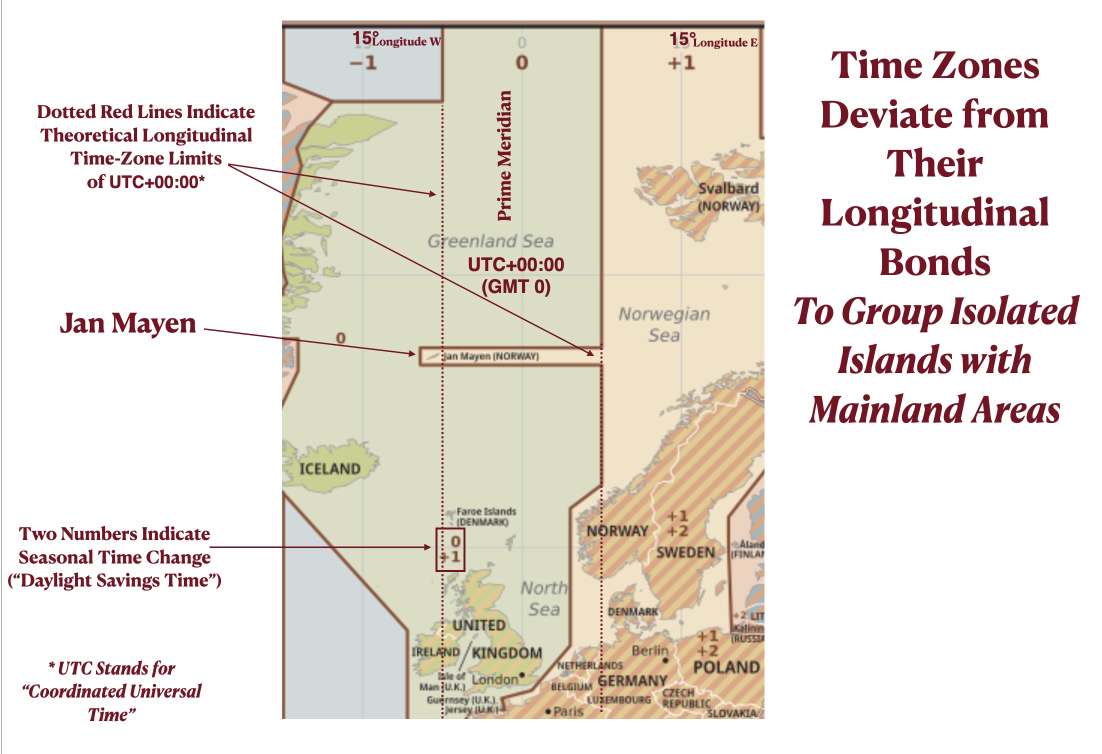
But as can be seen on the first map posted below, time zones are only structured this way in the uninhabited polar regions. Everywhere else, geopolitical considerations intrude. On land, time zones almost never follow the lines of longitude on which they are ideally based. Even in the open ocean, they often deviate from them to group islands and archipelagoes with other places. In the north Atlantic, for example, Jan Mayen is in the time zone commonly called GMT +1* (one hour ahead of Greenwich Mean Time), whereas by the logic of longitude it would be in time zone GMT -1 (one hour behind of Greenwich Mean Time). Not surprisingly, Jan Mayen is in the same time zone as Norway, the country that controls it. But note that western Norway would be in a different time zone (GMT 0) if longitude were the only factor.
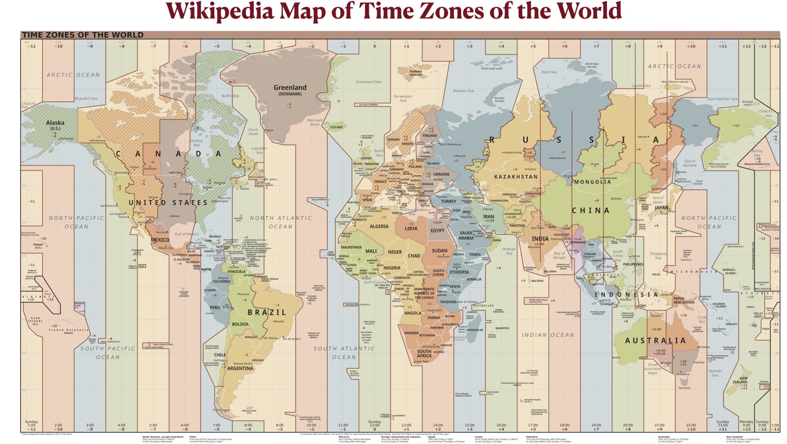
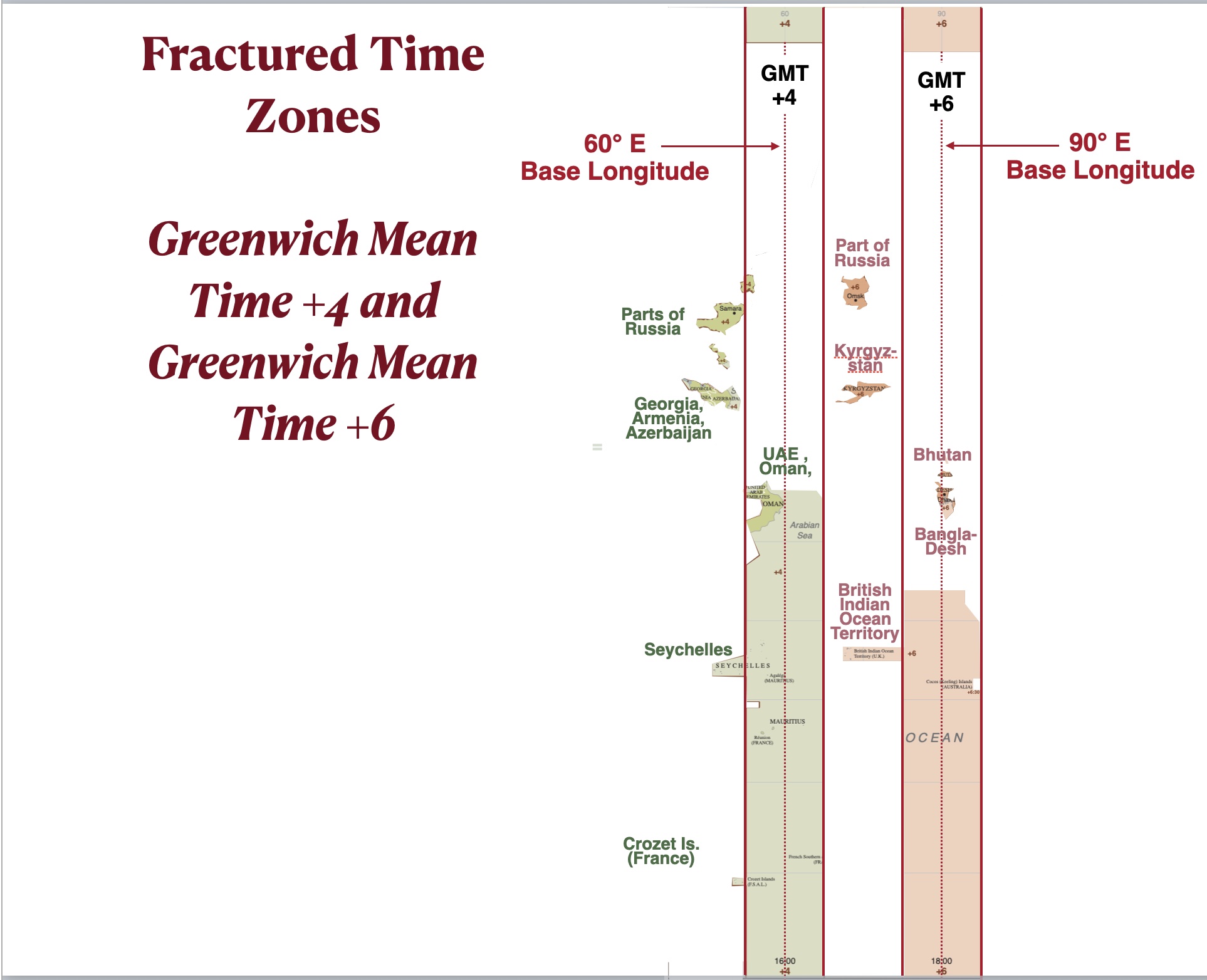
Some time zones almost disappear over continental landmasses, and where they do appear they can stray outside their ostensible longitudinal bounds. As can be seen in the map posted below, GMT+4 and GMT+6 (formally, UTC+04:00 and UTC+06:00) are prime examples. The only countries in GMT+4 that fit its longitudinal definition are Oman, the United Arab Emirates, Mauritius, and a small part Russia; Georgia, Armenia, Azerbaijan, and the Seychelles are also in GMT+4, but they are located outside its formal longitudinal range. GMT+6 has a similar geography. Bangladesh and Bhutan are the only countries using this time that are within its longitudinal bounds, while Kyrgyzstan and small piece of Russia also use it even though they are outside of its theoretical limits.
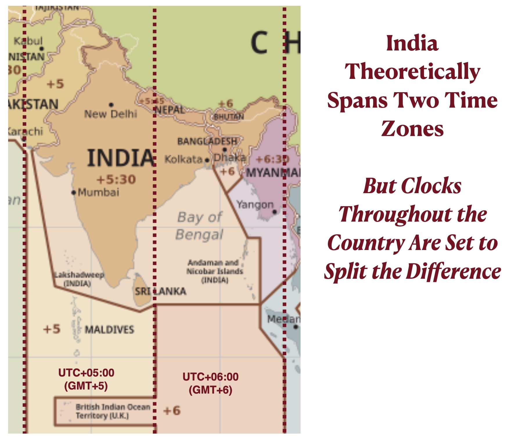
Many other major departures from the geometrical logic of 24 time zone, each based on 15° of longitude, can be seen on the global time-zone map. Most result from countries insisting on being on a single time zone regardless of their east/west span. India is a good example. By longitudinal logic, western and center India would be in GMT+5 (UTC+05:00), the same zone as Pakistan, while eastern India would be in GMT+6 (UTC+06:00), the same zone as Bangladesh. The Indian government opted to split the difference and put the whole country in the time zone officially designated as UTC+05:30. Nepal took this maneuver a step further, using GMT+5.45 for the whole country.
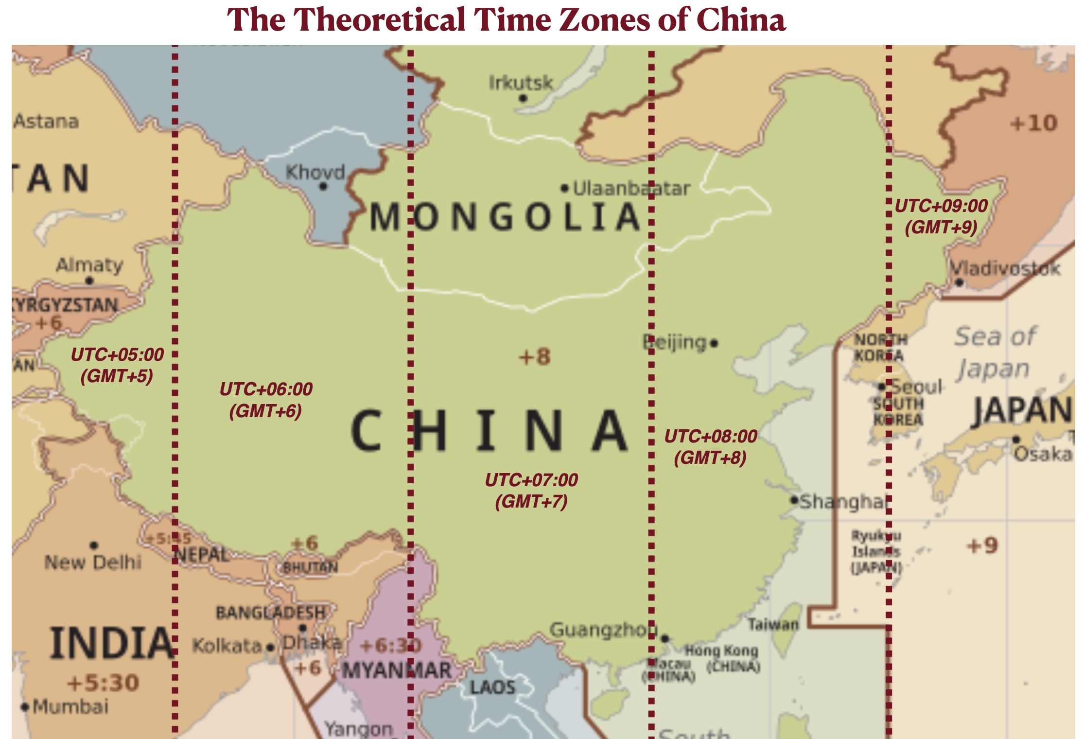
China is the extreme example of a country shoehorning a vast east/west span into a single time zone. China would extend over five time zones if it followed the strict longitudinal model. Instead, the whole country sets its clocks at GMT+8, using the time zone that is theoretically reserved for eastern China, the political and economic core of the country. As a result, in western China 12:00 PM, or “clock noon,” falls in the middle of the morning.
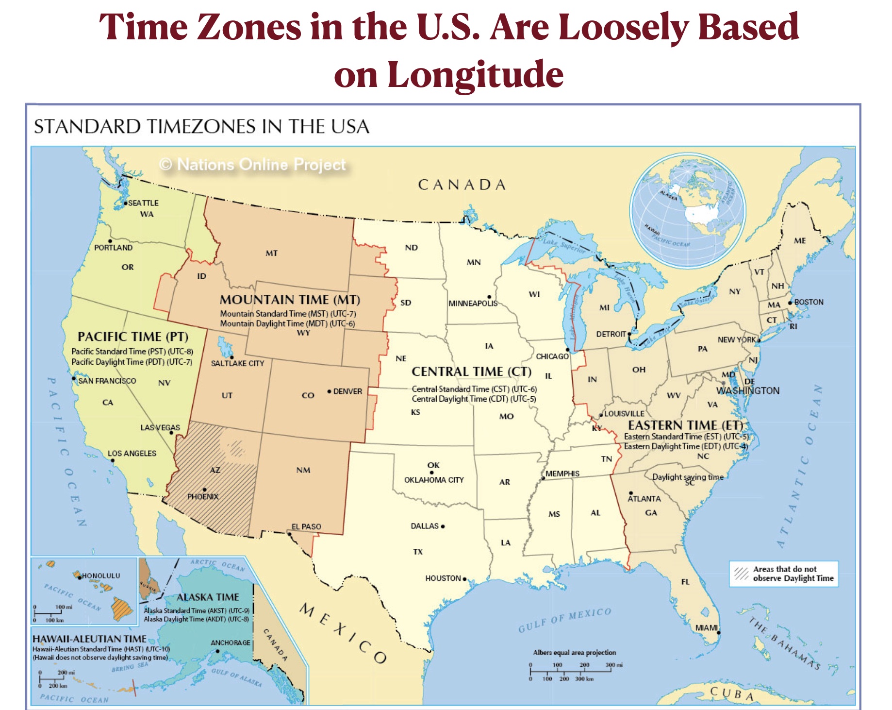
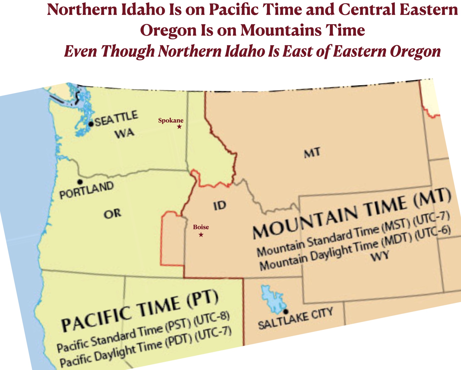
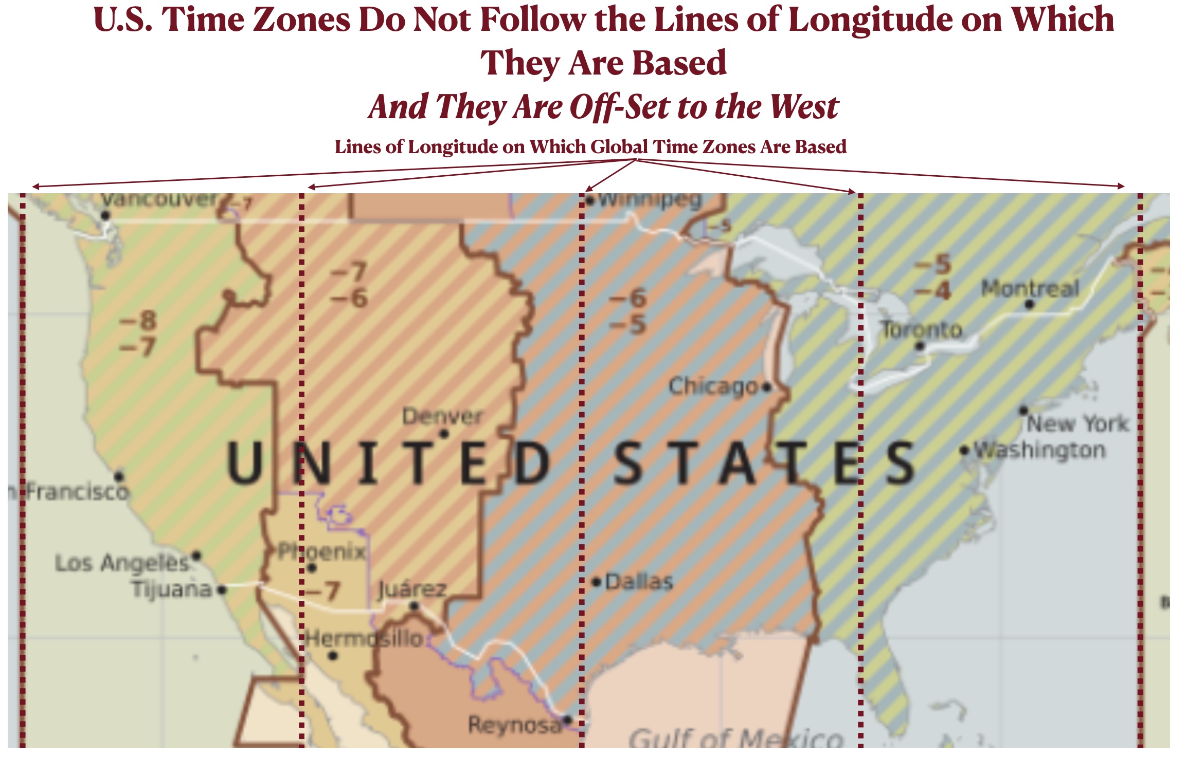
In the United States as well, time zones do not closely follow lines of longitude. Instead, they take into account state and county boundaries. One reason for these deviations is the inconvenience that would result from dividing extended metropolitan area into two time zones. In the U.S. west, for example, northern Idaho is on Pacific Time while much of eastern Oregon is on Mountain Time, even though northern Idaho is east of eastern Oregon. This arrangement makes sense because northern Idaho is oriented toward Spokane, Washington, which is on Pacific Time, while eastern Oregon is oriented toward Boise, Idaho, which is on Mountain Time. But as can be seen on the map posted below, if time zones in the U.S. strictly followed the lines of longitude on which they are ostensibly based, both of these regions would be on Pacific Time.
* More formally, this time zone is designated “UTC+00:00,” or “Coordinated Universal Time 00:00. ” As explained in a Wikipedia article on the subject:
UTC+00:00 is an identifier for a time offset from UTC of +00:00. This time zone is the basis of Coordinated Universal Time (UTC) and all other time zones are based on it. In ISO 8601, an example of the associated time would be written as 2069-01-01T12:12:34+00:00. It is also known by the following geographical or historical names:
- Greenwich Mean Time
- Western European Time
- Azores Summer Time
- Eastern Greenland Summer Time
- Western Sahara Standard Time
- Coordinated Universal Time