As was noted in an earlier post, most maps made in the 1500s and 1600s were relatively accurate in the north/south direction but often strikingly inaccurate in the east/west direction. This discrepancy was because latitude was relatively easy to determine (by the midday sun angle or by the position of the north star), whereas longitude could only be estimated. The inability to measure longitude led to countless shipwrecks, demanding a response. The problem was finally solved in the late 1700s by the development of better clocks.
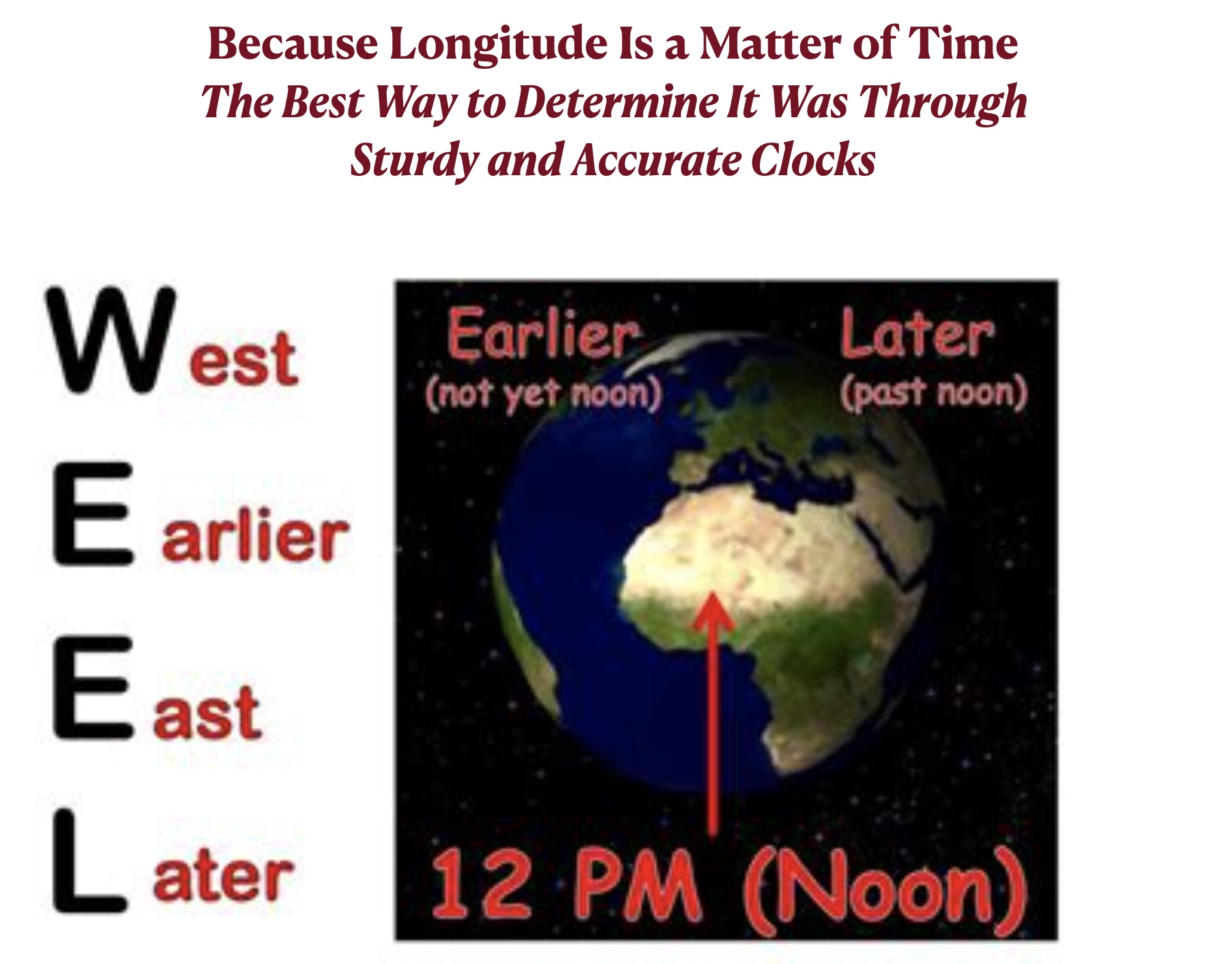
Most students, in my experience, are surprised to learn that sturdy and accurate clocks allowed mariners to determine longitude. But whereas latitude is mainly a matter of sun angles, longitude is mainly a matter of time. Owing to the rotation of the Earth, places to the east of one’s own position are later in the day while places to the west are earlier. As modern travelers know, the time-disruption known as jetlag only occurs when one flies a long distance to the east or west, not to the north or south.
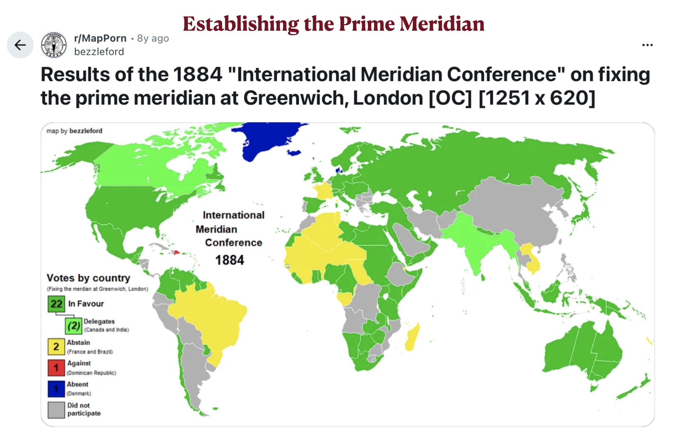
So how could an accurate clock sturdy enough to keep time on stormy seas allow navigators to plot longitude? The purpose of such “marine chronometers,” as they were called, was not to track local time, which was continually changing as one sailed to the east or west. Shipboard time could be set by observing when the sun reached its highest position, which marked noon. The ship’s chronometer, in contrast, indicated the time experienced at a different longitude, which was deemed 0°, or the “Prime Meridian.” As the chronometer was developed in Britain, those who first used the device designated the line of longitude passing through the British Royal Observatory in Greenwich, England as the Prime Meridian. At the International Meridian Conference, held in 1884 in Washington, D.C., representatives from 26 countries agreed to accept Greenwich as marking longitude 0°. Since then, its designation as the Prime Meridian has been essentially universal.*
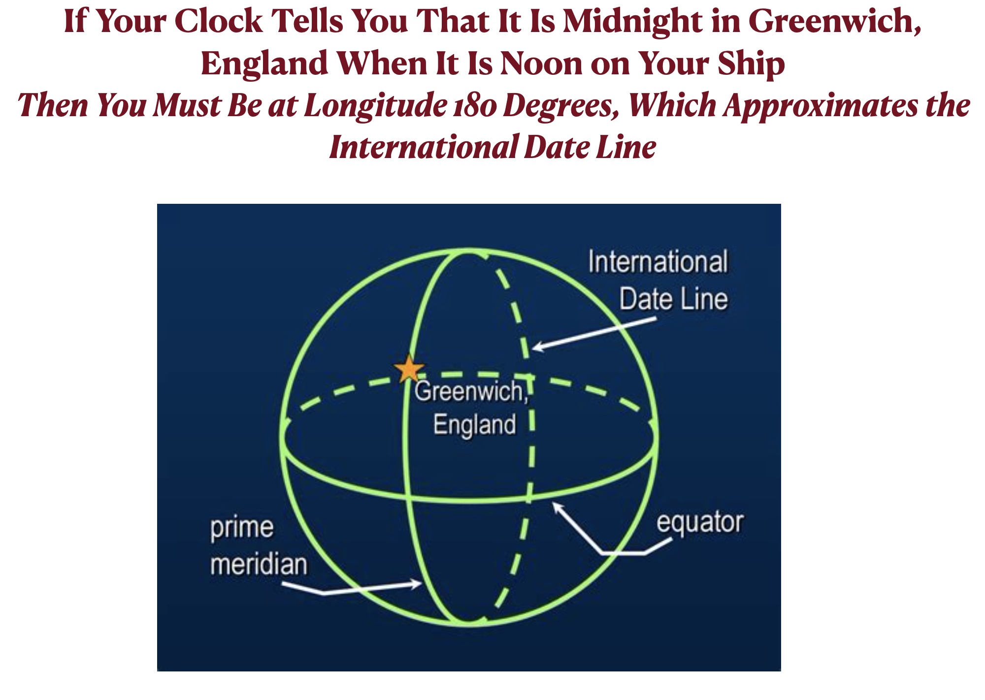
The procedure for determining longitude by a chronometer set to the time in Greenwich was relatively simple. If the clock recorded that that it was midnight at Greenwich when it was noon on a ship, the vessel had to be on the opposite side of the world from the Prime Meridian, or Longitude 180°. If noon on the ship corresponded to 6:00 PM at Greenwich, the ship had to be at longitude 90°W, or one quarter the way around the world toward the west. By the same reasoning, if it was 6:00 AM at Greenwich when the local time was noon, the ship was one quarter the way around the world in the other direction, or at longitude 90° E.
The story of the development of the maritime chronometer and the determination of longitude is fascinating and instructive. It has been admirably told by writer Dava Sobel in her book Longitude: The True Story of a Lone Genius Who Solved the Greatest Scientific Problem of His Time.

*France long resisted the designation of the line of longitude passing through Greenwich as the Prime Meridian as well as the global establishment of “Greenwich Mean Time.” France abstained on the vote in 1884 (as did Brazil, while the Dominican Republic voted against the measure). As noted in the Wikipedia article on the International Meridian Conference, “The French did not adopt the Greenwich meridian as the beginning of the universal day until 1911. Even then it refused to use the name “Greenwich”, instead using the term “Paris mean time, retarded by 9 minutes and 21 seconds”. France finally replaced this phrase with “Coordinated Universal Time” (UTC) in 1978.”