As recent GeoCurrents posts have argued, latitude is distinctive from longitude, just as the north/south direction is distinctive from the east/west direction. To put it simply, longitude, like east and west, is relative, whereas latitude, like north and south, is absolute. Partly because of this difference, people tend to prioritize north/south orientations over east/west orientations when looking at maps and thinking about spatial relationships. Although this tendency is understandable, it can cause geographical confusion and misperceptions.
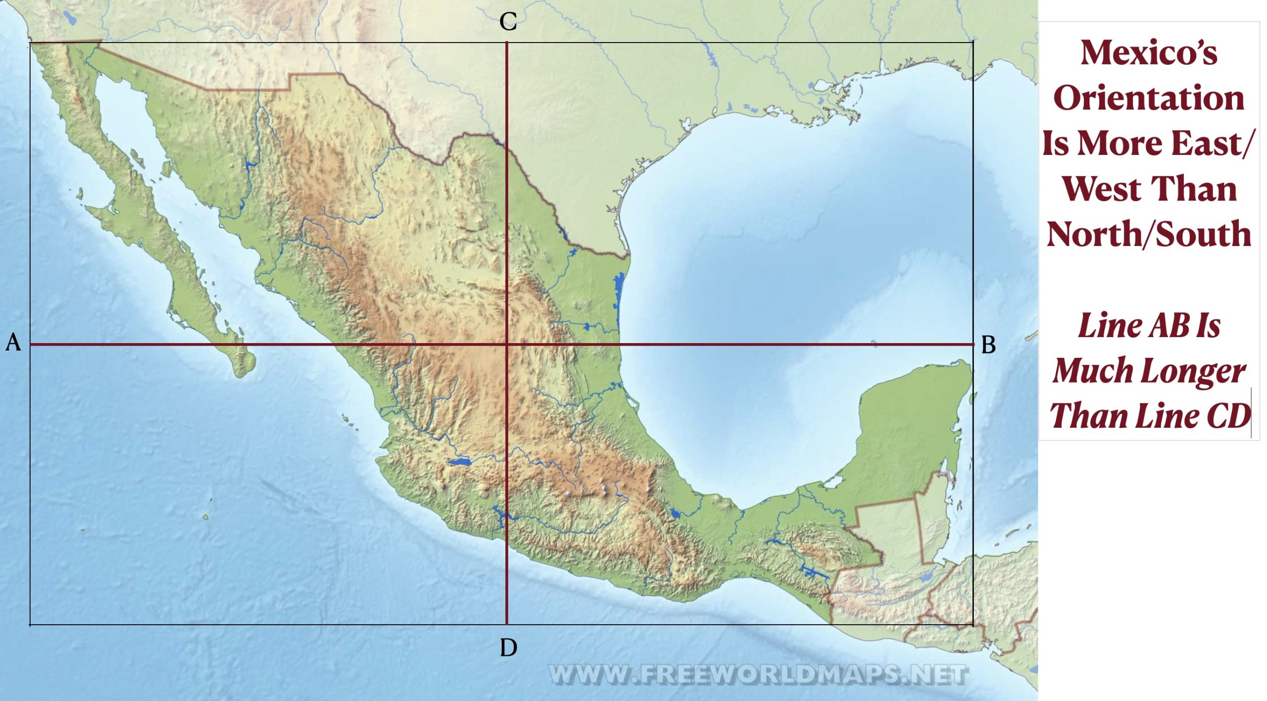
The priority of north & south over east & west is most evident in geographical perceptions of countries with northwest/southeast orientations. Generally, these places are regarded as being divided into northern and southern regions but not eastern and western ones. Mexico is a prime example. Although the country extends much farther from east to west (3,230 km) than from north to south (2,020 km), people often speak of “southern Mexico” and “northern Mexico” but rarely mention “eastern” Mexico or “western Mexico.
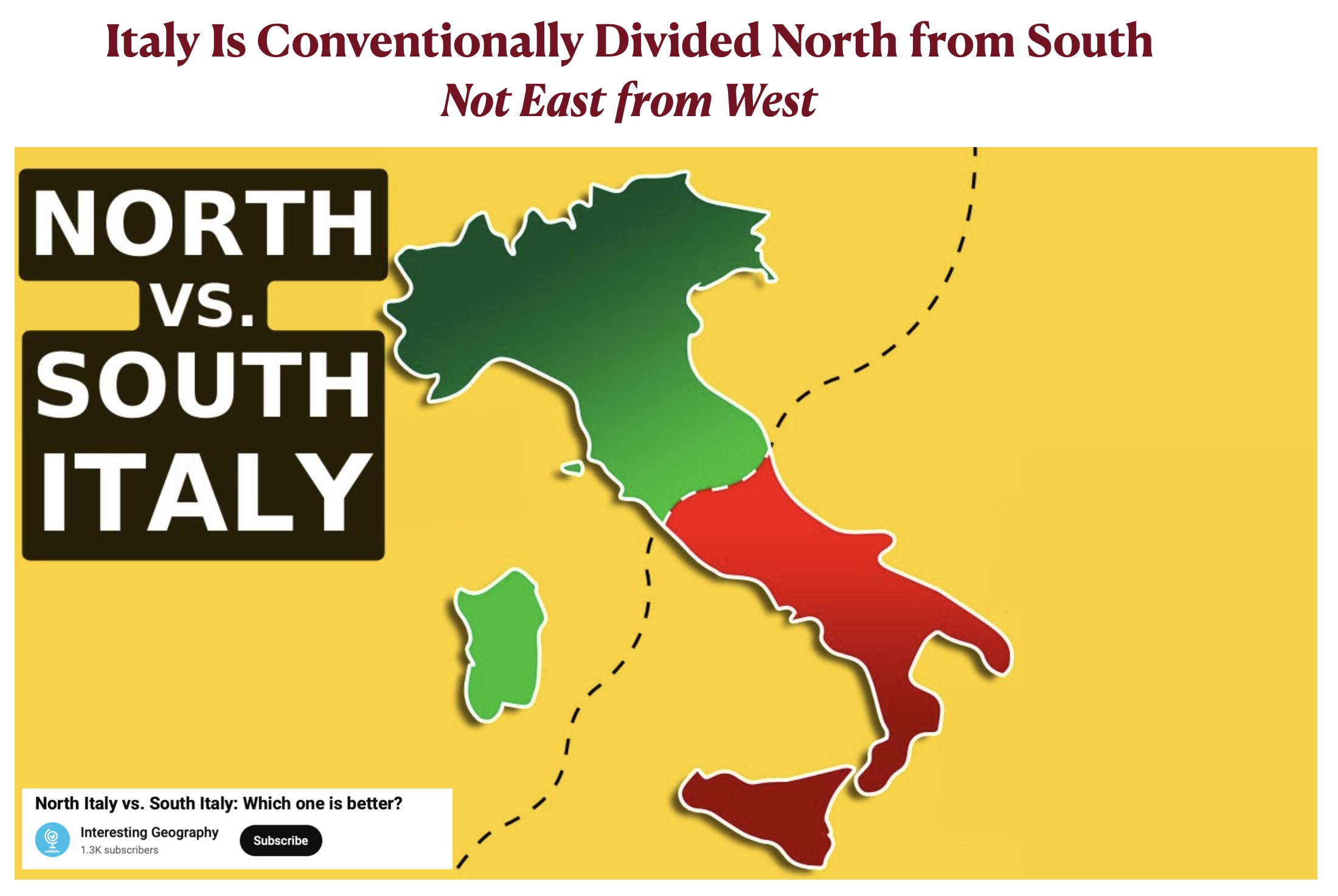
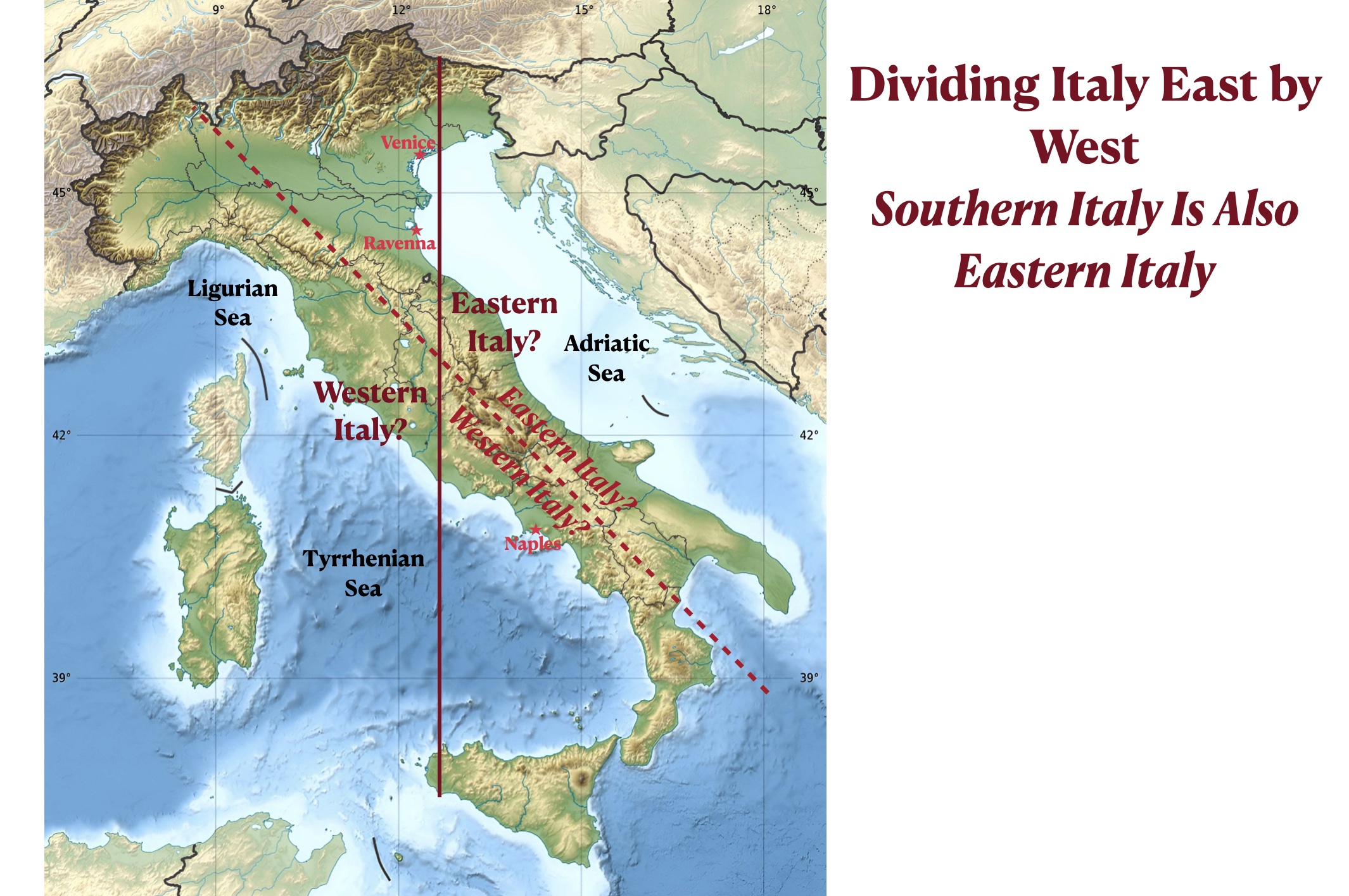
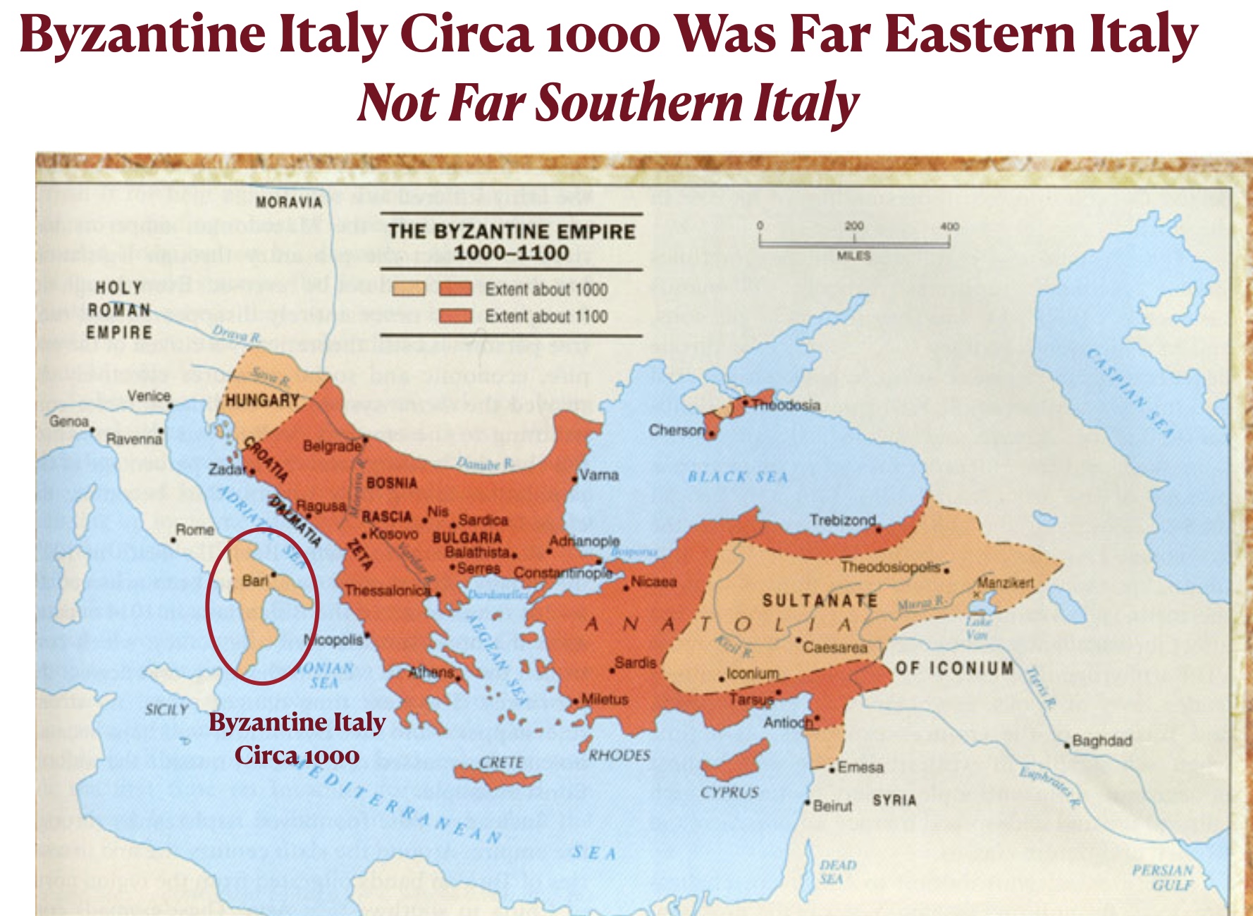
The same perceptions apply to Italy. Southern Italy is also eastern Italy, but it is almost never regarded as such. “Eastern Italy,” to the extent that the term is used, generally denotes the Adriatic side of the peninsula, while “western Italy” refers to the side facing the Tyrrhenian and Ligurian seas. But by this understandable way of thinking, some parts of western Italy are east of some parts of eastern Italy. Naples, for example, is well to the east of both Venice and Ravenna. Historically, the Byzantine Empire circa 1000 is conceptualized as having controlled southern Italy, but its holdings were limited to the eastern extremity of the peninsula, with its Italian boundary at the time running in the north/south direction. It also did not control Sicily.
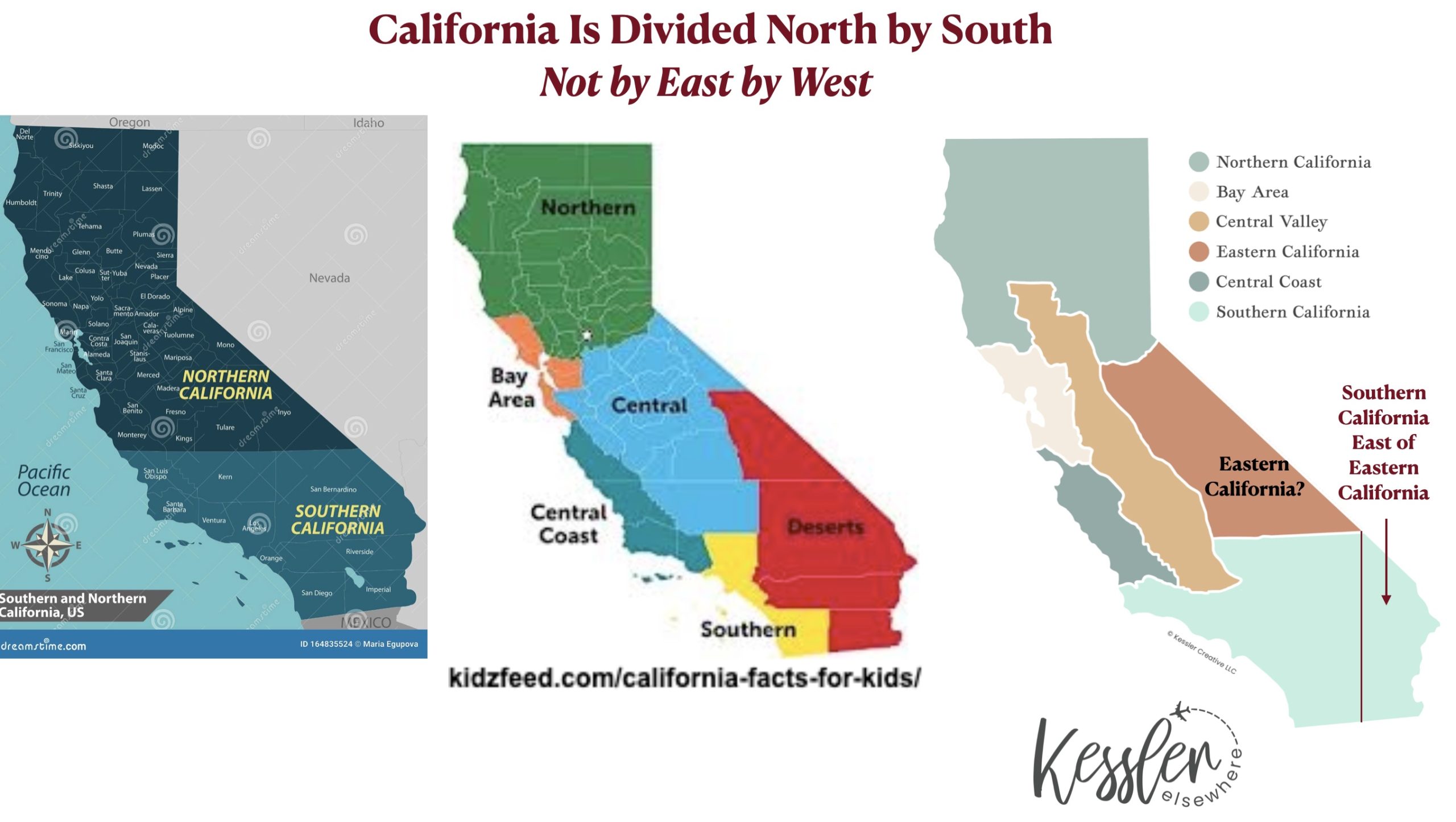
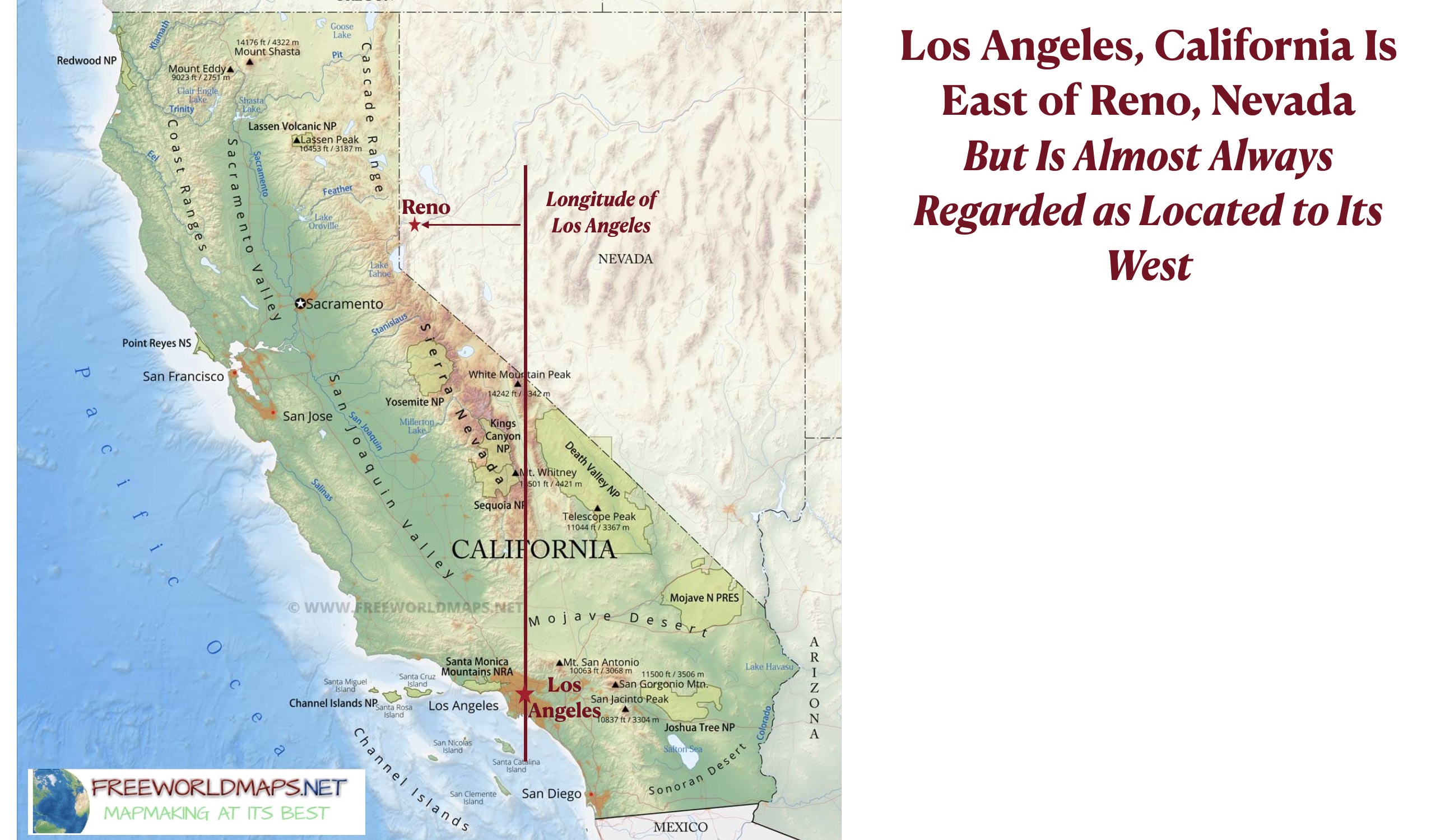
In the United States, California falls in the same category. Southern California is also eastern California while northern California is also western California, although they are almost never perceived as such. The term “western California” is rarely, if ever, used. “Eastern California” is occasionally encountered to refer to the eastern part of the central portion of the state, but in this formulation “southern California” is offset to the east of “eastern California.” Our difficulty in perceiving southern California’s eastern position makes some facts seem surprising. Very few Americans, for example, can correctly answer the following question: “What is the largest U.S. city that is east of Reno, Nevada and west of Denver Colorado?” The answer, as can be seen on the final map posted below, is Los Angeles, California.
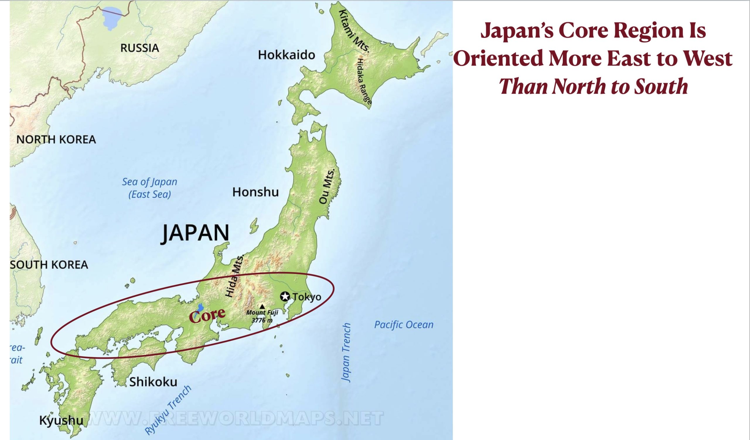
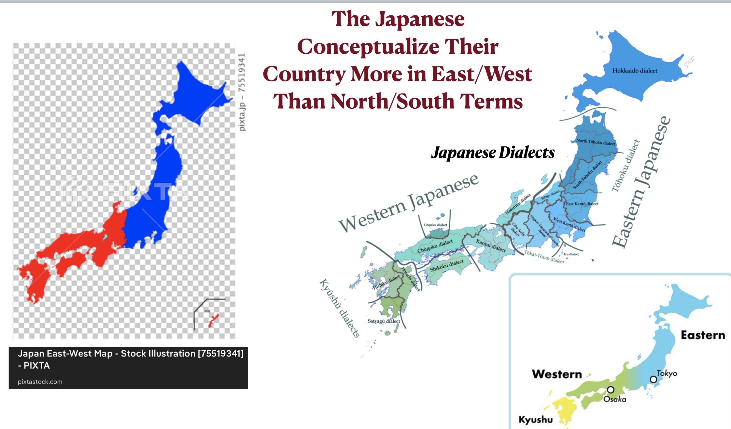
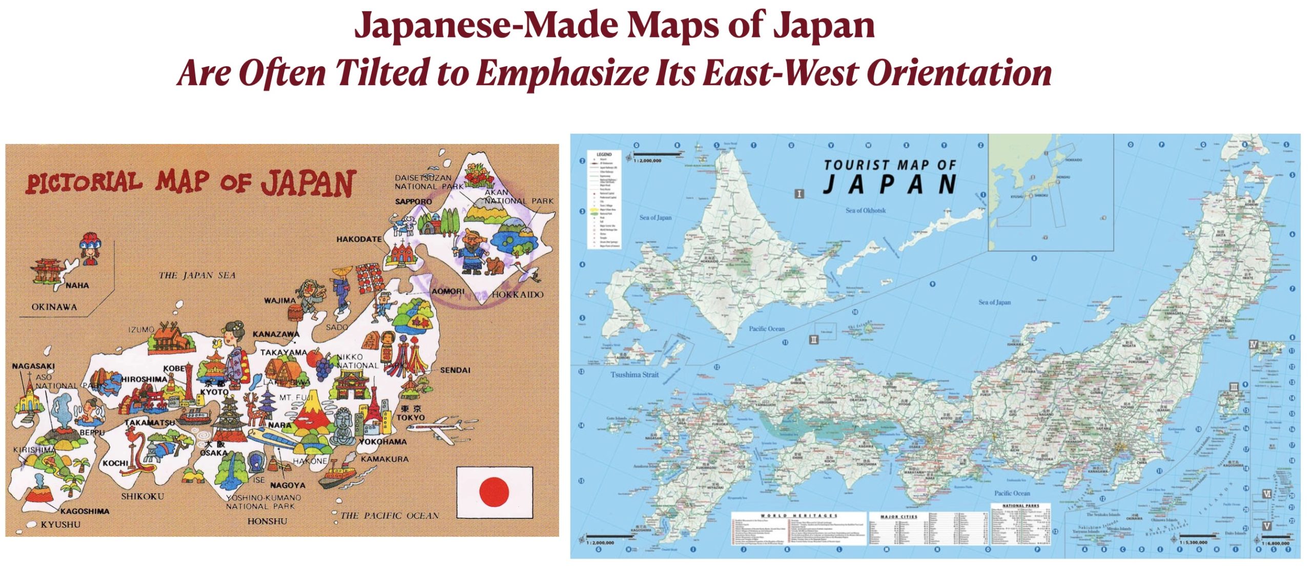
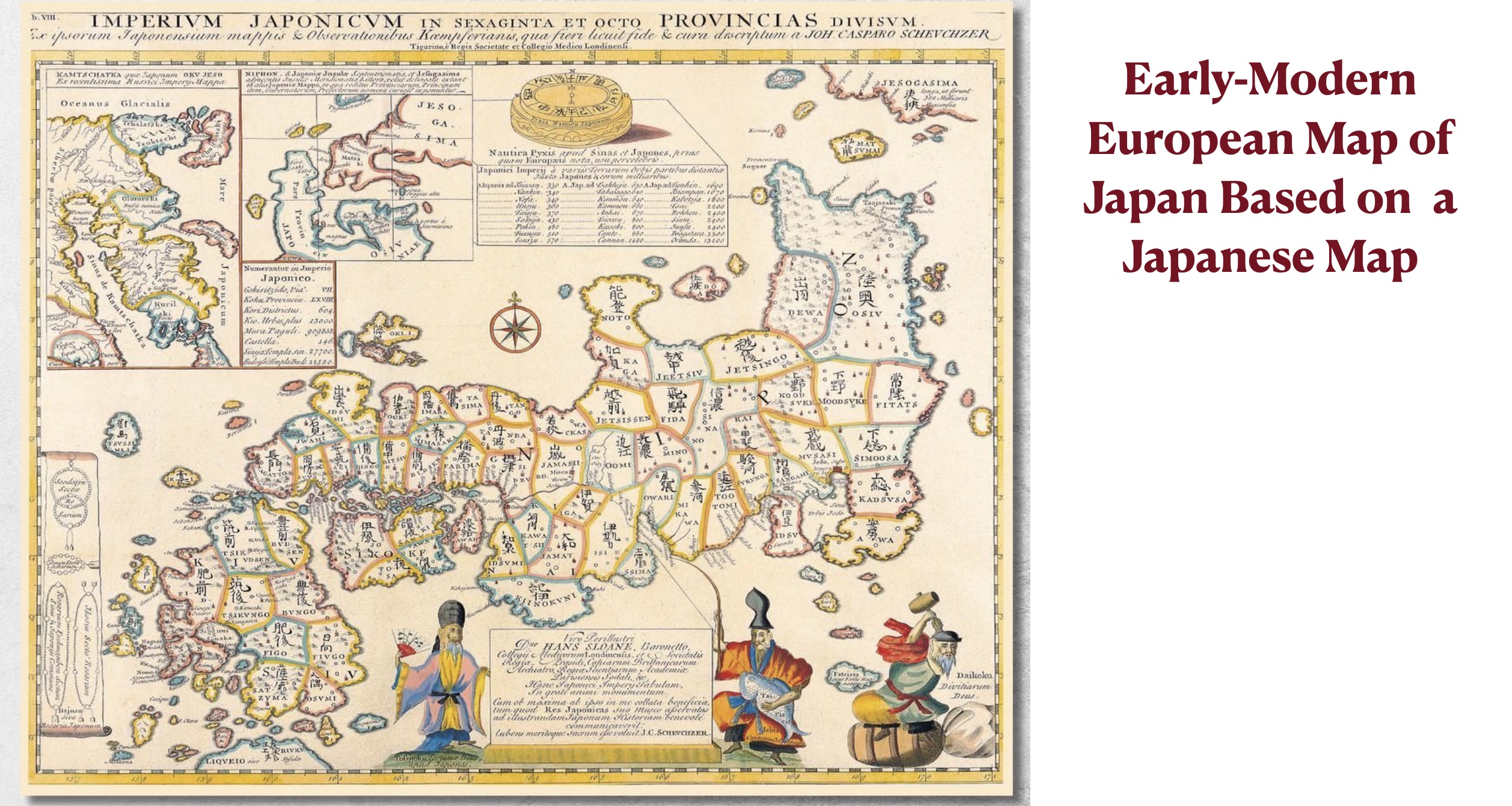
Japan seems like a significant exception to this generalization. Although the country has a larger latitudinal than longitudinal range, the Japanese people almost always divide it east by west rather than north by south. This is partly because its demographic and economic core area has a largely east/west orientation. Historical factors are also important. Japan’s northernmost island, Hokkaido, was not part of the country until the late 1800s. North/south trending northeastern Honshu, moreover, was long a peripheral part of the country, and as a result was diminished in size in most traditional Japanese maps. Many modern maps of Japan are tilted to emphasize this east/west orientation, as can be seen in the final figure posted below.
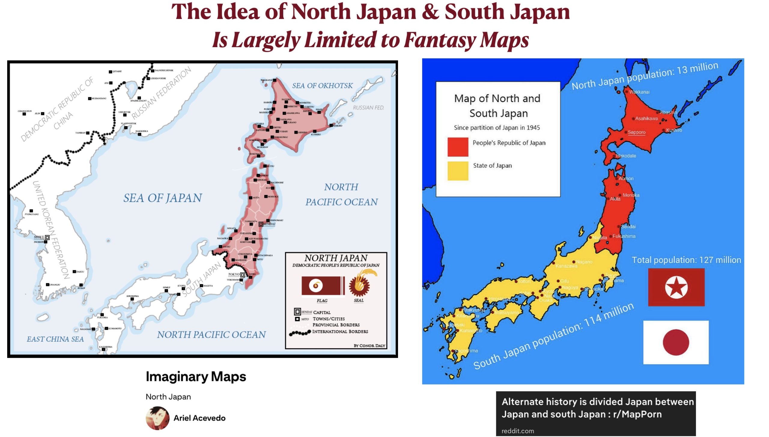
Non-Japanese people, in contrast, often think of Japan in north/south terms. In the realm of alternative history and its associated games, maps showing “North Japan” and “South Japan” are abundant. Most of these maps are based on the counter-factual premise that the country was partitioned after World War II in much the same way that Korea was divided into South Korea and North Korea. Note that on the second map below the imagined “North Japan” would have a current population of only 13 million as against the 111 million of the hypothetical “South Japan.”