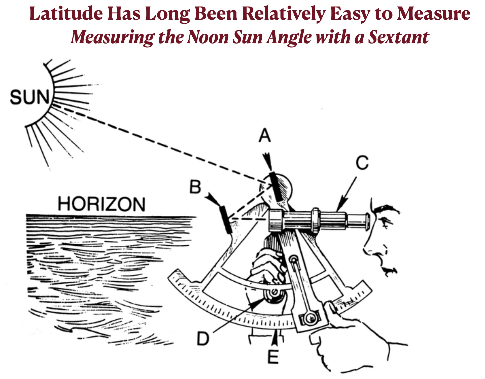
Latitude, as we have seen, is closely connected to midday sun angles. Because of this relationship, latitude has long been relatively simply to measure. Four hundred years ago, navigators could easily determine how far they were to the north or south of the Equator if the day was clear and they had kept track of the date. All they had to do was measure the angle of the sun at its highest position and consult a table that gave the latitude at which the sun reached the zenith on that day. If, for example, they measured the noon sun angle at 60° on March 20, when the sun is directly overhead at the Equator (0°), their own latitude had to be 30°.
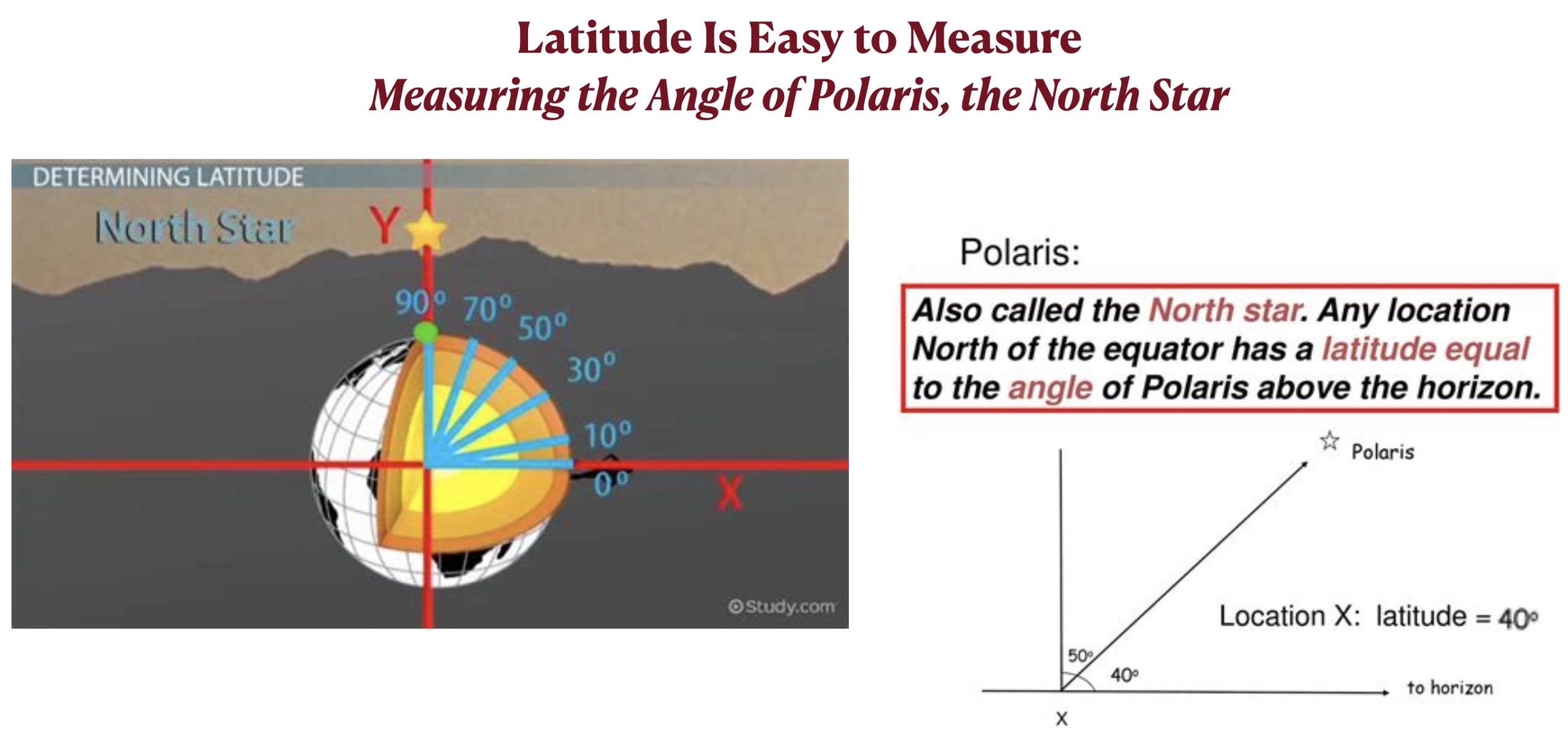
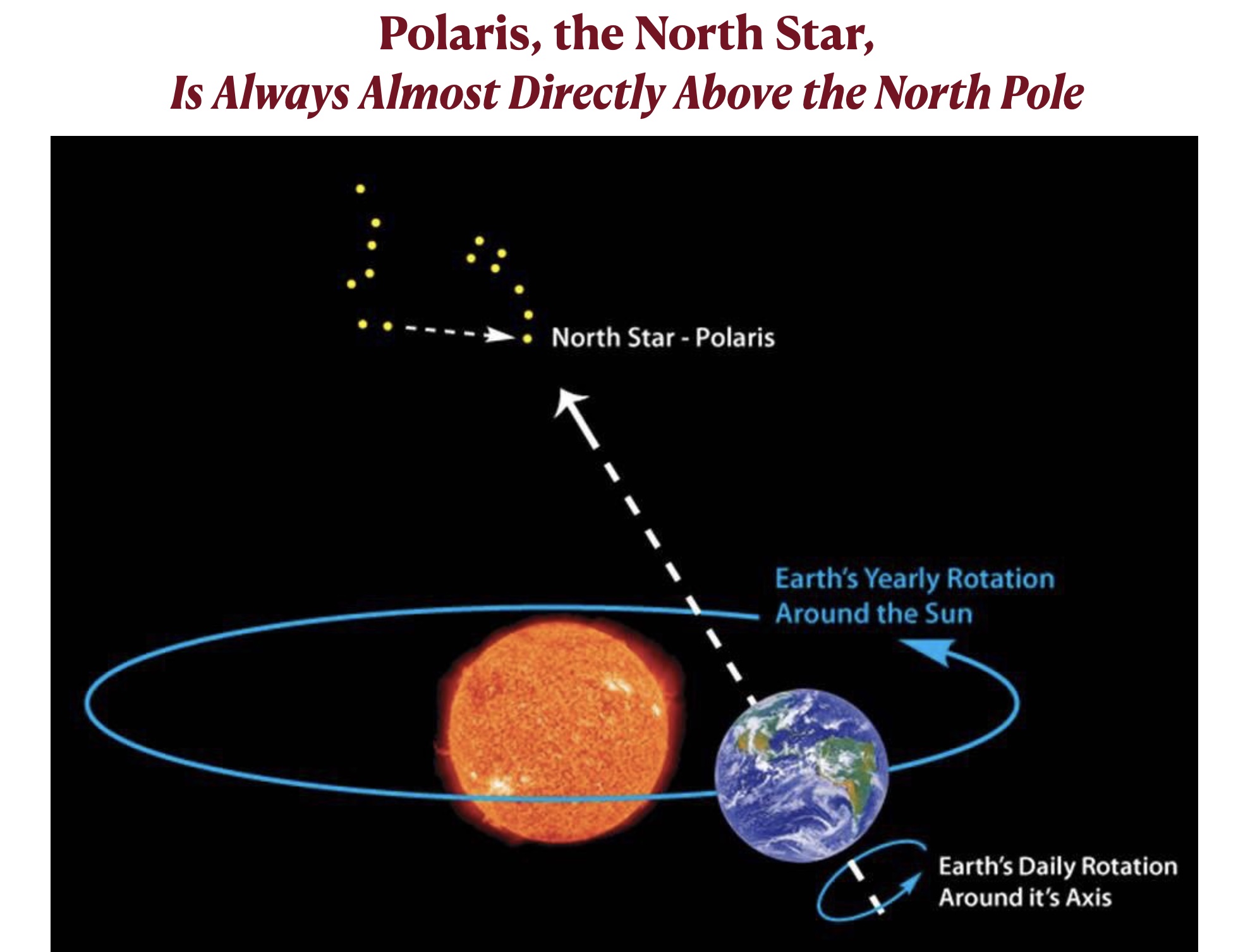
On a clear night in the Northern Hemisphere [1], navigators could also measure the angle of the North Star, also called Polaris, which is always almost directly above the North Pole. The farther they had sailed to the north, the higher in the sky the North Star would be. In fact, the angle of Polaris is equal to the latitude of the observer. If Polaris is measured at 70° above the horizon, then the place at which the measurement is made must be 70° N latitude. At the North Pole, 90°N latitude, North Star is almost exactly overhead, or 90° above the horizon.
Sailors were not the only people to rely on the North Star for navigation. In the United States before the Civil War, escaped slaves heading for freedom usually traveled at night without a compass or map. To keep traveling northward, they typically used Polaris as a guide.
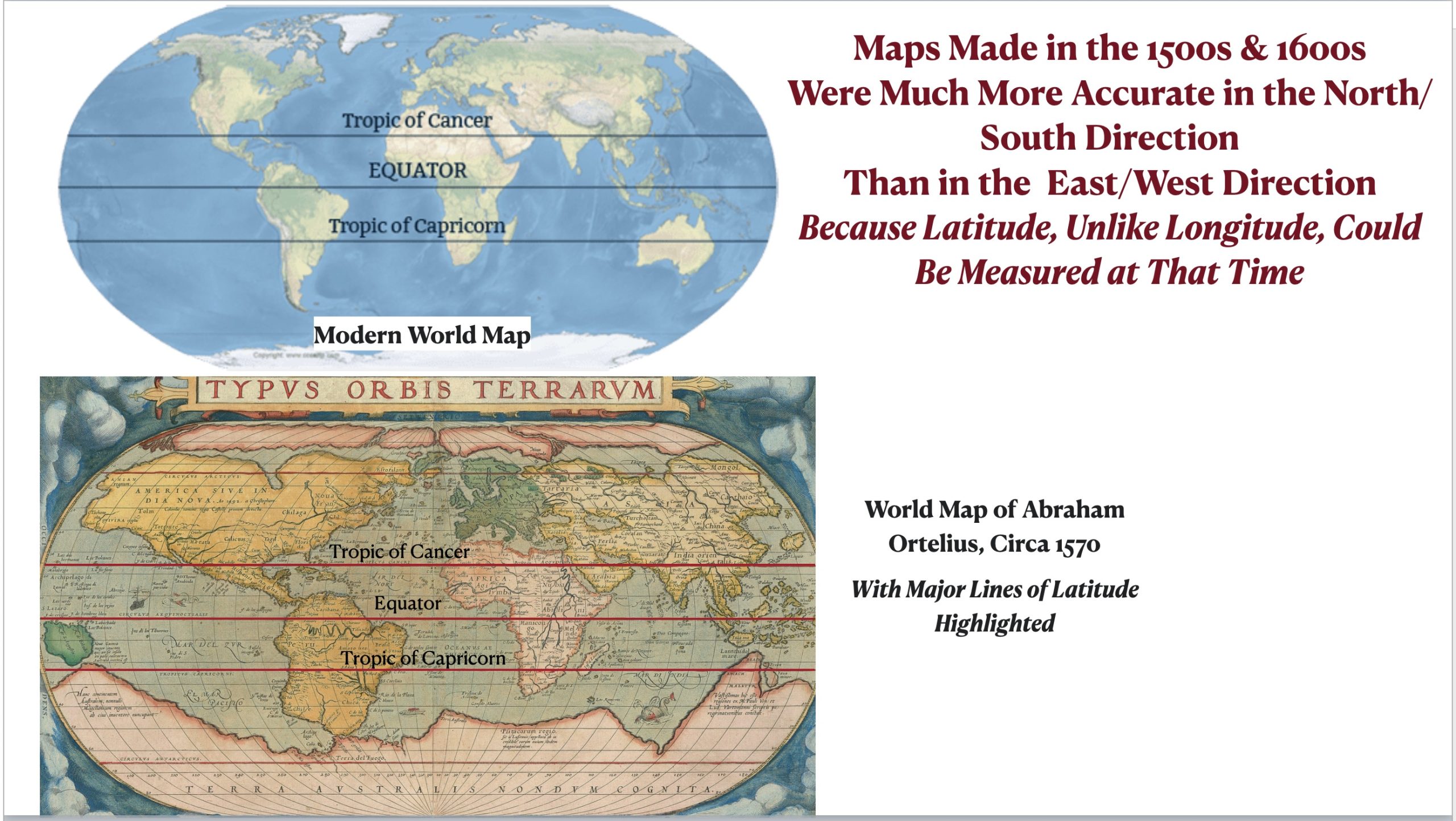
Because latitude has long been measurable, most world maps made in the 1500s and 1600s have a relatively high degree of accuracy in the north-south direction. Those same maps, however, are often strikingly inaccurate in the east-west direction. In those days, a ship’s longitude, or position in the east/west direction, could not be measured. Inaccurate maps resulted in countless shipwrecks, creating a huge problem that demanded a solution. As we will see in a later post, the solution to the longitude problem was to develop sturdy clocks that would remain accurate on storm-tossed ships. If latitude is essentially about sun angles, longitude is essentially about time.
The paired maps posted illustrate the higher degree of accuracy of early maps in the north/south direction (latitude) than in the east/west direction (longitude). If you trace out the Equator and the tropics of Cancer and Capricorn on the Ortelius map, made around 1570, and the compare them with the same lines on the modern map, you will see that they generally pass through the same places. On both maps, for example, the Tropic of Cancer just clips the Mexican peninsula of Baja California and passes just to the north of Cuba. Similarly, the Equator cuts just to the south of the Malay Peninsula on both maps. In contrast, many longitudinal positions vary greatly on the two maps. South America, for example, is shown as extending across many more degrees of longitude in the Ortelius map than it actually does.
[1]. There is a similarly positioned “South Star,” Sigma Octantis, that could conceivably be used for the same purpose in the Southern Hemisphere. It, however, “is too dim to be a convenient celestial reference point for stargazers and navigators.”