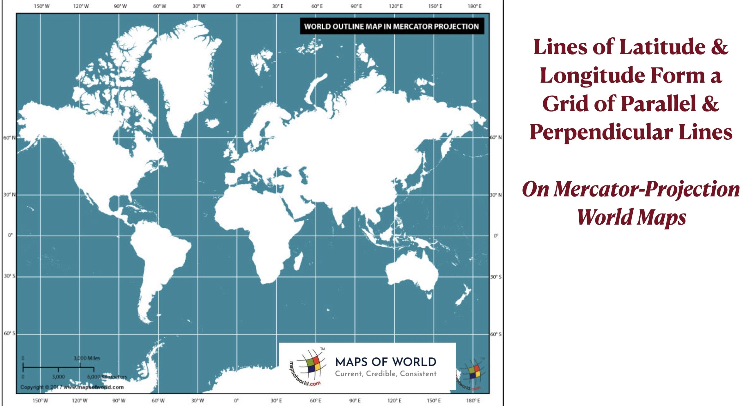
At first glance, latitude and longitude seem like equivalent concepts. On any local-scale map, lines of latitude (parallels) and longitude (meridians) form a grid, with the two sets of lines intersecting at 90° angles. On such maps, lines of longitude as well as those of latitude appear to be parallel to each other. Many world maps, such as those using a Mercator projection, have the same appearance, with latitude and longitude forming a grid of rectangles.
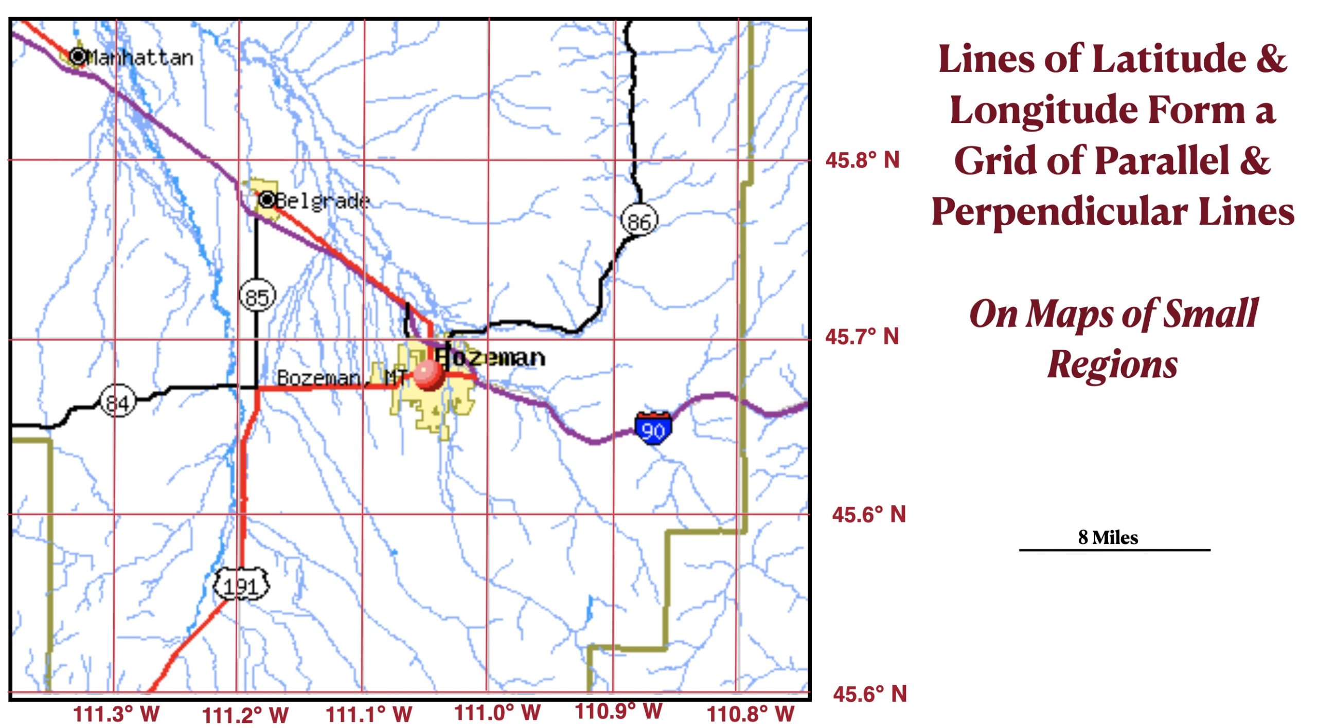
Such maps, however, are misleading, as longitude is very different from latitude. And as can be seen on a globe, they do not actually form a grid with the two sets of lines intersecting at 90° angles. Only lines of latitude are parallel to each other and are always the same distance apart, approximately 69 miles per degree. Lines of longitude are also approximately 69 miles per degree – but only at the Equator. The farther they are from the Equator, the closer they are to each other. In Bozeman, Montana, which is about halfway between the Equator and the North Pole, a degree of longitude covers about 49 miles, and at latitude 85° the figure is only six miles. At the poles, all lines of longitude converge at a single point.
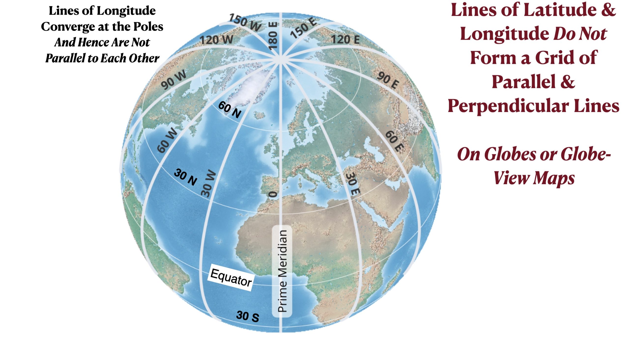
Lines of latitude and longitude also differ in length. All meridians (lines of longitude) are of the same length. Running from the South Pole to the North Pole, they go halfway around the Earth, approximately 12,430 miles. The Equator, latitude 0°, goes all the way around the Earth and is approximately 24,901 miles long. But the farther they are from the Equator, the shorter the parallels (lines of latitude) become. The 45° latitude line, which is just a little south of Bozeman, is approximately 17,617 miles long, whereas the 85° latitude line is only 434 miles long. At 90°, the north and south poles, latitude does not form a line at all but is instead reduced to a single point.
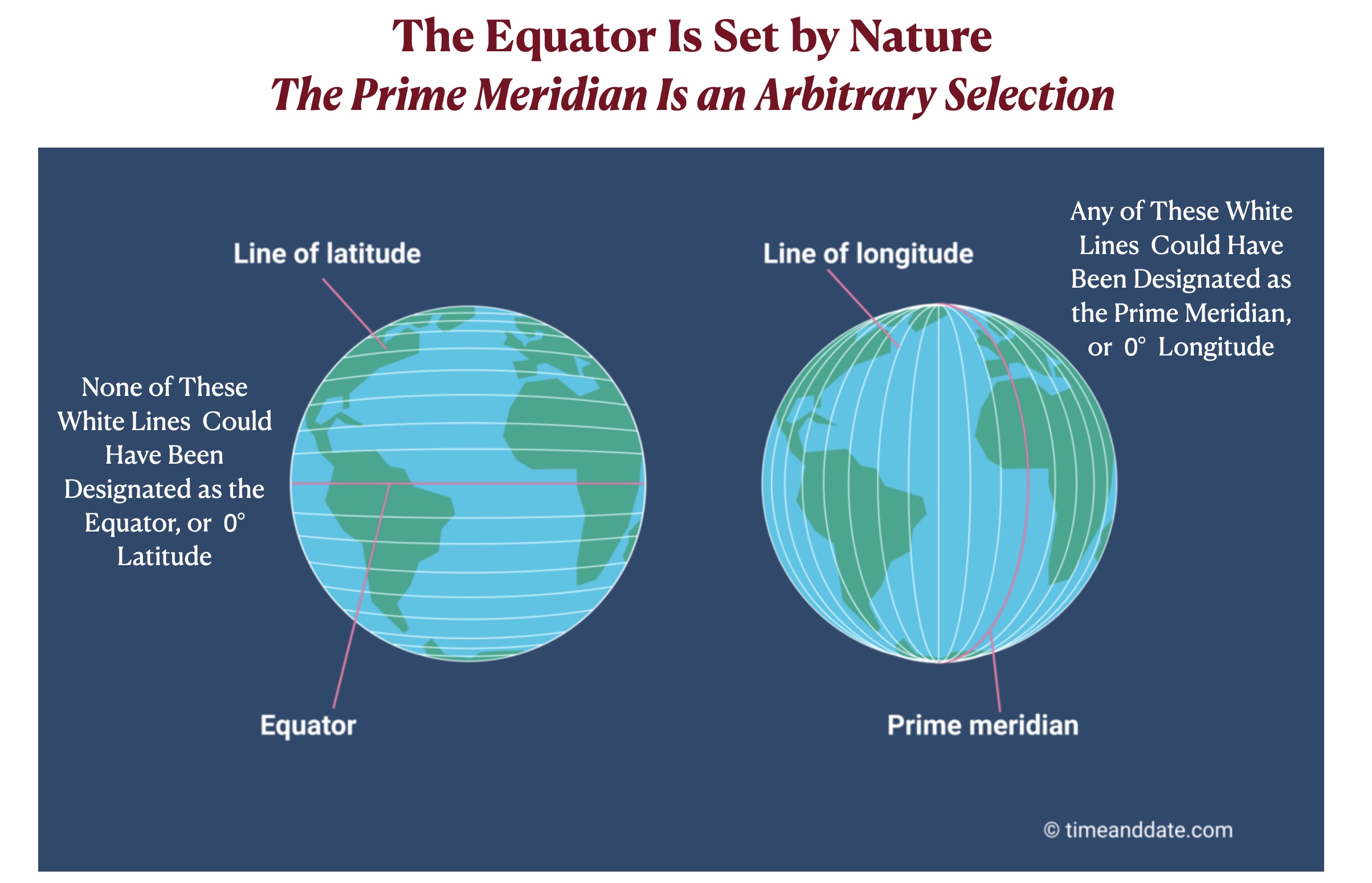
Perhaps the most important biggest difference between these two groups of imaginary lines is the fact that latitude designations are set by nature whereas longitude designations are essentially arbitrary creations of the human mind. The Equator and the poles are defined by the spin of the Earth’s around its axis and therefore have fixed locations. All other lines of latitude are defined in relation to the Equator and the poles and therefore could only be located exactly where they appear on maps and globes. But longitude is different. The Prime Meridian, 0° longitude, could be any line that runs from the North Pole to the South Pole. In earlier times, different lines of longitude were defined as 0°. Consider for example, the well-known world map of Abraham Ortelius, made around 1570. On this map, the Prime Meridian runs through the Atlantic Ocean, whereas today it runs through western Europe and western Africa. Ortelius also measured longitude from 0° to 360°, going all the way around the Earth, which makes perfect sense. Today we measure longitude from 0° to 180° to the west and to the east of the Prime Meridian, which is equally reasonable. In contrast, measuring latitude in any way other than from 0° to 90° makes no sense at all.

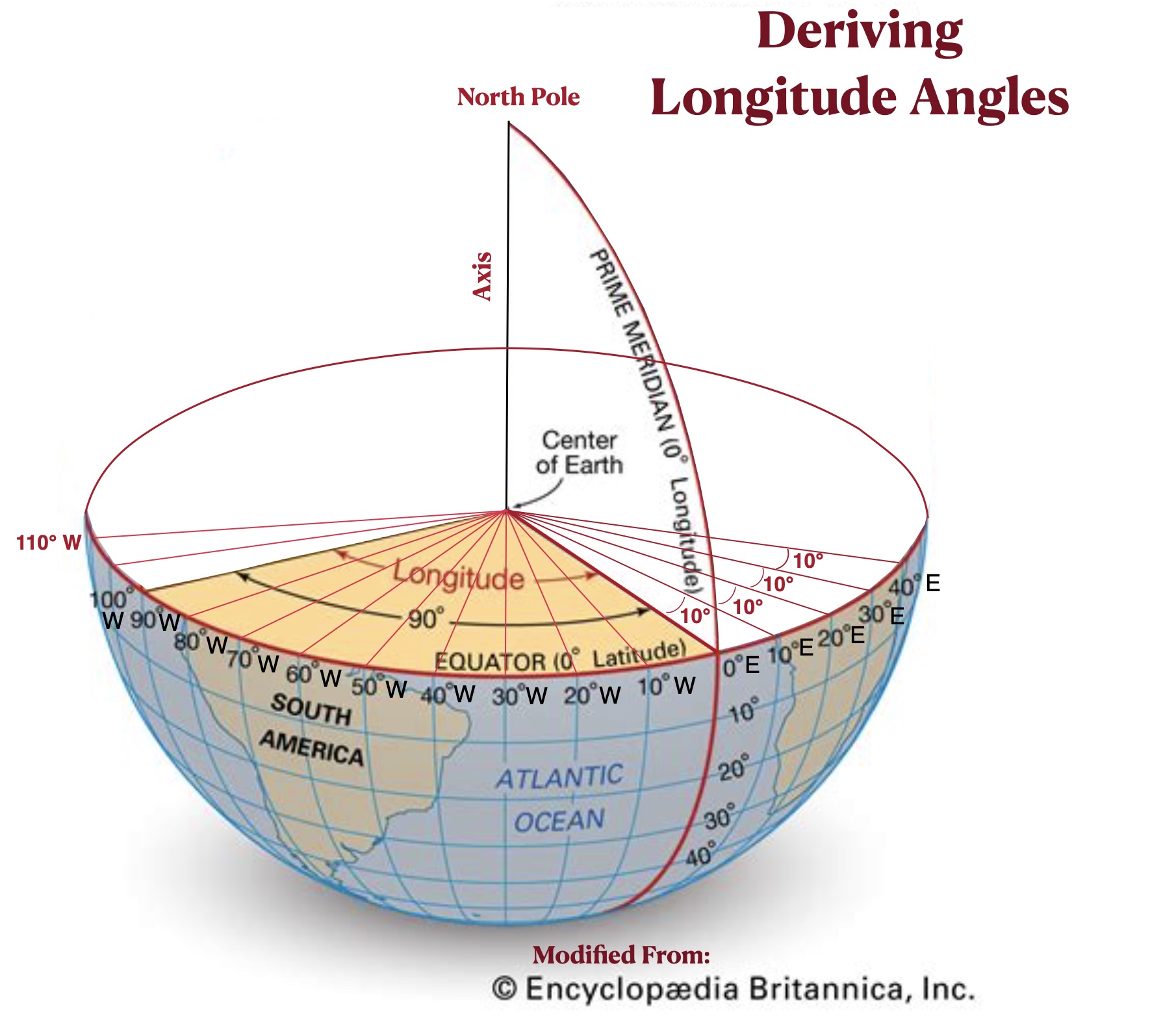
To see how lines of longitude are measured as angles we can once again imagine a slicing a globe in half, only this time through the equator. Again, circles are formed on the flat sides of the two resulting hemispheres. A line drawn from the center of one of these circles to any point on its edge could be used to define the Prime Meridian, a line running from that point on the surface of the Earth to both poles. Other lines going from the center to the edge of the circle form angles with the Prime Meridian, which are used to define the other meridians. The diagram posted below shows a series of 10° angles, which in turn define a series of longitude lines separated from each other by 10° (which range, on this diagram, from 40° east to 110° west of the Prime Meridian.)
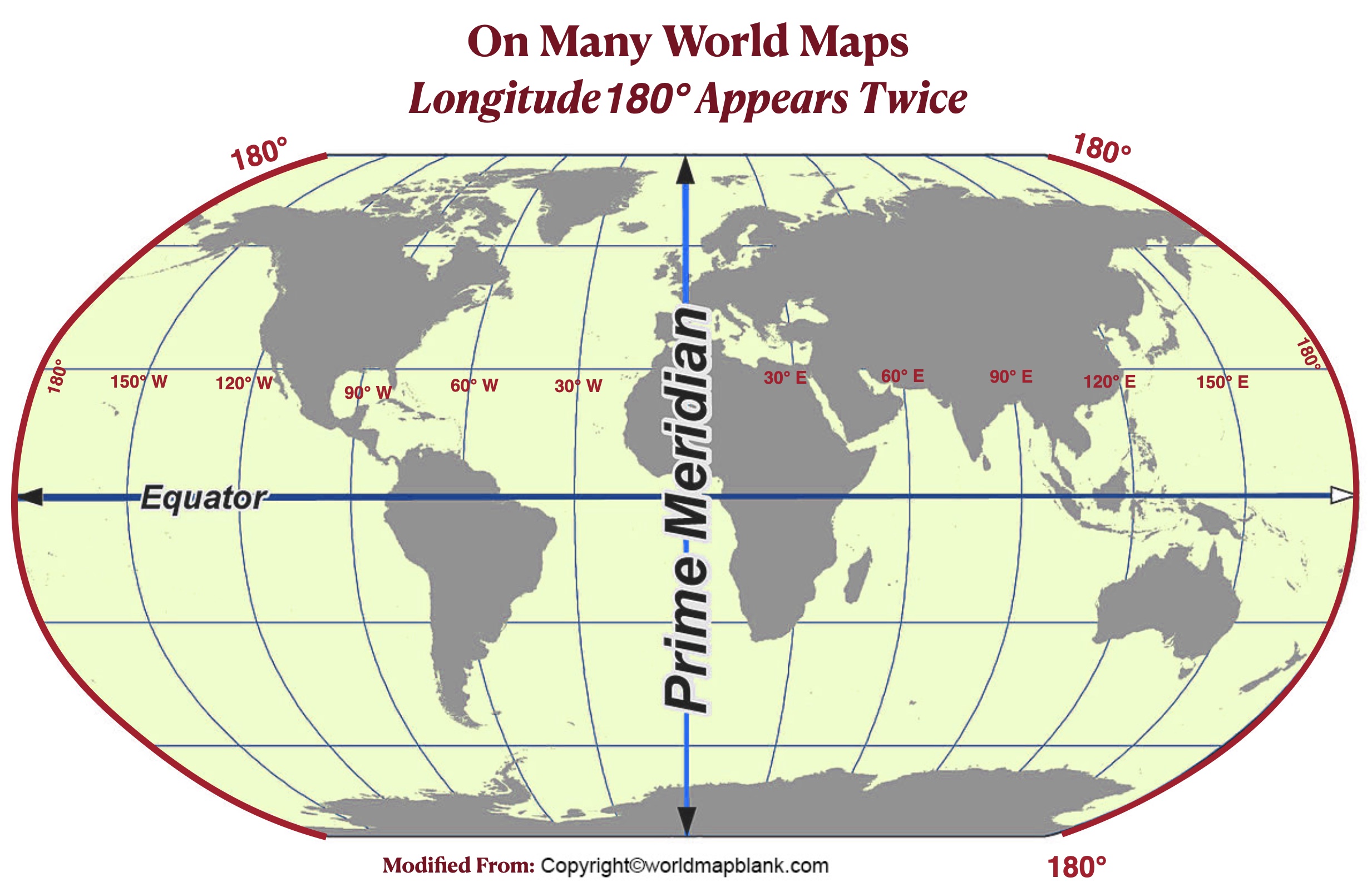
On the opposite side of the Earth from the Prime Meridian is the 180° degree line of longitude. As it is equally far to the west as it is to the east of 0° longitude, it does not have an “E” or “W” designation. On many world maps, this line of longitude appears twice, on both the left side and the right side of the image. The 180° degree line of longitude also forms the foundation of the International Date Line, as we will see in a later post.
Because longitude is quite different from latitude, the east/west direction is quite different from the north/south direction, as we will see in the next post.