(This is the tenth post in a series aimed at helping parents home-school their children, aimed those who live in Bozeman, Montana. It is, however, misplaced in the sequence, as it should come after the post on the rotation of the Earth. Once all the posts have been posted, they will be rearranged in the correct order.)
After students have learned about the Equator, they should be introduced to the other major lines on the globe: latitude and longitude. Lines of latitude circle [1] the earth parallel to the Equator and are therefore also called “parallels.” Parallels are labeled in degrees above and below the Equator, ranging from 0° at the Equator to 90° at the poles, as is explained below. The length of parallels decreases with distance from the Equator. At the north and south poles, latitude is reduced to a point and thus has no length at all.
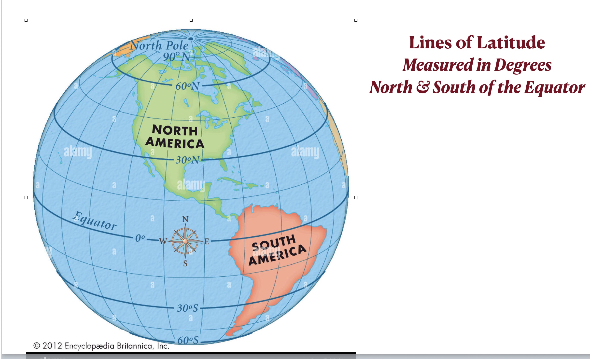
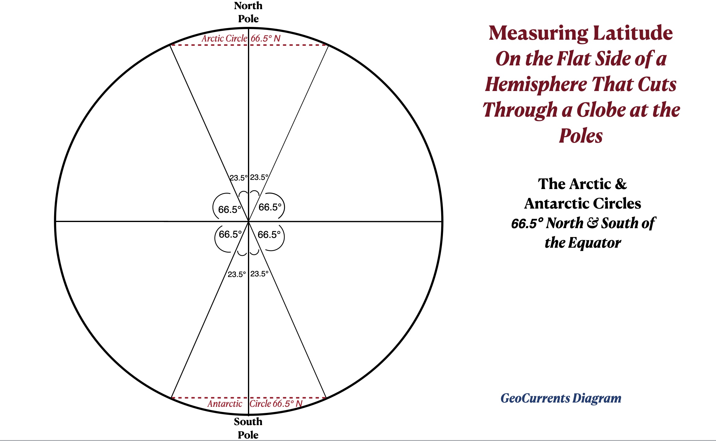
In addition to the Equator, four other major lines of latitude are marked on most globe: the Arctic Circle, the Tropic of Cancer, the Tropic of Capricorn, and the Antarctic Circle. All are related to the tilt of the Earth’s axis. The zone between the Tropic of Cancer and the Tropic of Capricorn is called the tropics (or the Torrid Zone), while the areas to the north of the Arctic Circle and to the south of the Antarctic Circle are called the polar regions (or the frigid zone). The two broad belts between the tropical and polar regions in each hemisphere are called the midlatitudes (or the temperate zones).
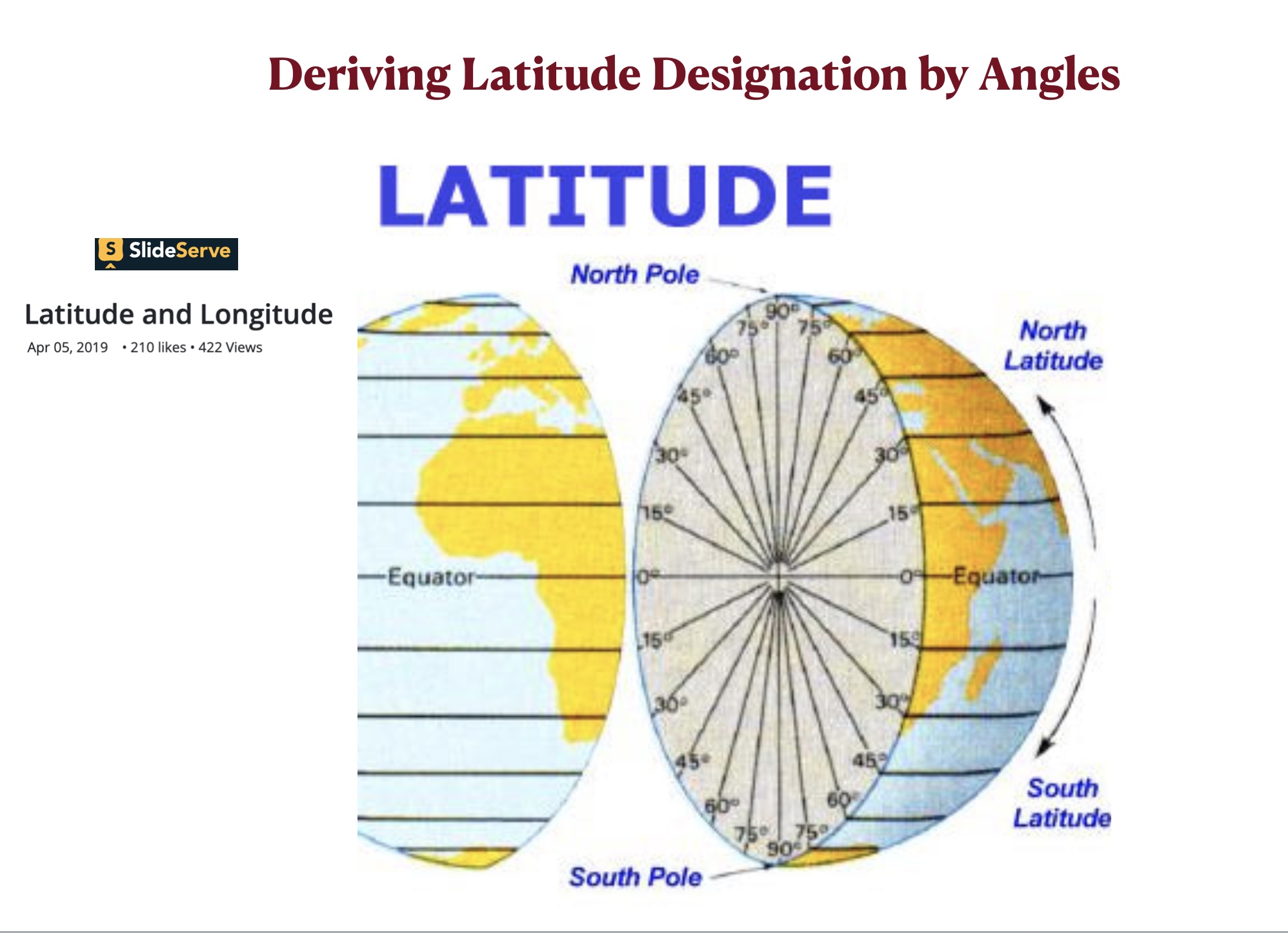
Lines of longitude, or meridians, run from the North Pole to the South Pole. They are not parallel to each other, as they all converge at the poles. Unlike the lines of latitude, they all have the same length, which is half the circumference of the Earth. Longitude is also labeled in degrees, ranging 0° at the Prime Meridian, which runs through eastern Great Britain, to 180° on the other side of the world in the Pacific Ocean. As longitude will be considered at length in a later post, the remainder of this post focuses on latitude.
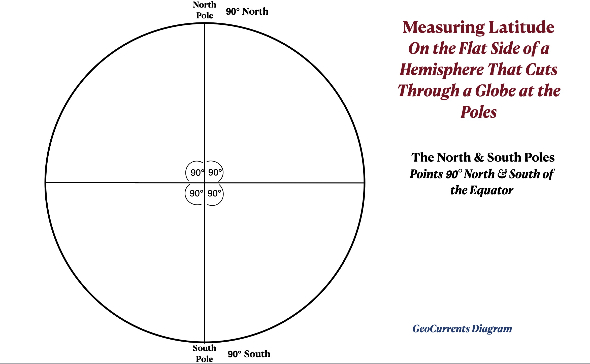
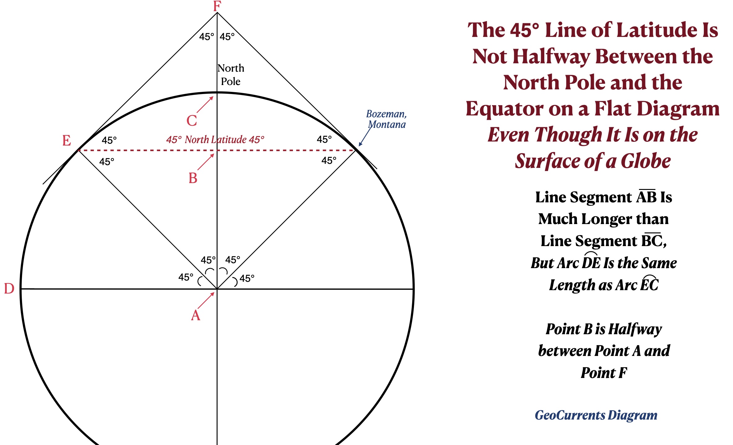
For students who have studied geometry, the next step is to show how latitude is defined and labeled. Latitude is measured in degrees of a quarter circle, ranging from 0° to 90°. To see how these numbers are reached, imagine cutting a globe in half through the North and South Poles, perpendicular to the Equator. The two resulting hemispheres have identical circles on their flat sides, which can be represented by a single two-dimensional diagram. A horizonal line passing through the center of this circle represents the Equator [2]. A line perpendicular to this equatorial line represents the earth’s axis, which ends at the north and south poles. As the angles between the equatorial line and the axis line are 90°, the North Pole is designated as 90° N (north) latitude and the South Pole is designated as 90° S (south) latitude.
A straight line drawn from the center to the edge of the circle halfway between the Equator and the North Pole forms a 45° angle with the equatorial line. A curved line drawn at this distance from the equator around the round side of the hemisphere created by slicing the globe in half traces out half of the 45° line of latitude. If the same procedure is done with the other hemisphere and then the two half-spheres are joined back together, the entire 45° line of latitude will have been traced out.
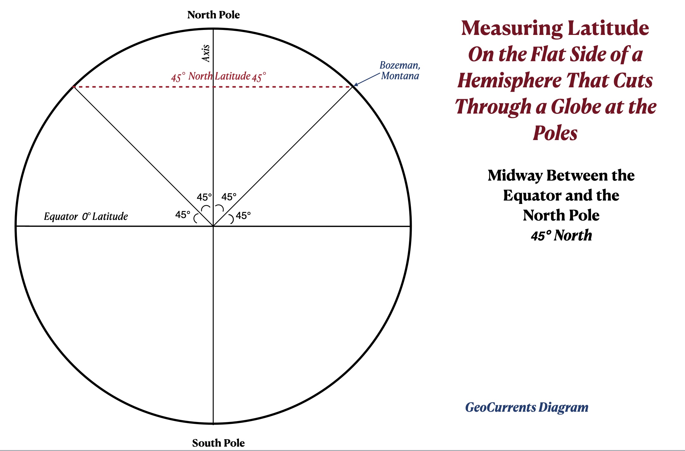
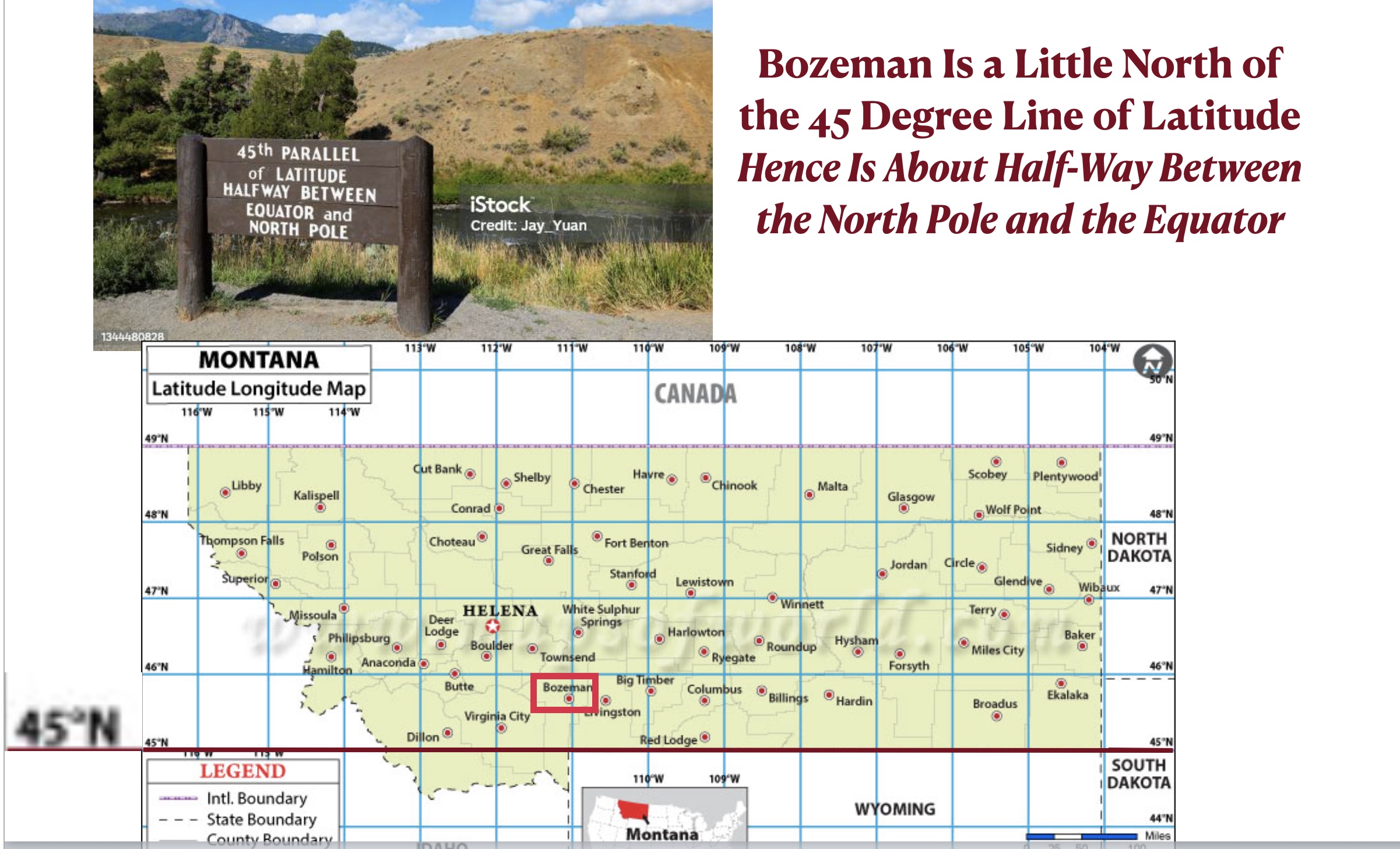
If you are standing anywhere on the 45° N parallel, you will be exactly halfway between the Equator and the North Pole. The border between Montana and Wyoming follows this line of latitude. As Bozeman is just 47 miles to its north, we will treat it as if it had a latitude of 45° (the actual figure is 45.68°). Note, however, that on the diagram posted above, the 45° line of latitude does is not halfway between the Equator and the North Pole. This seeming discrepancy can be explained by the geometry of circles, as is illustrated in the diagram posted below.
As was noted above, four major lines of latitude, in addition to the Equator are marked on most globes: Arctic Circle, the Tropic of Cancer, the Tropic of Capricorn, and the Antarctic Circle. They are all related to the tilt of the Earth’s axis, which is approximately 23.5°. The two tropics form the same angle with the Equator, 23.5° [3]. The Arctic and Antarctic circles follow the 66.5° lines of latitude [4], which means that they form 23.5° angles with the Earth’s axis (23.5 + 66.5 = 90). The correspondence between the tilt of the axis and these four major lines of latitude is reflected in the angle of the sun that they experience at different times of the year, as will be explained in the next post.

[1]. Because they are actually curved lines that go around the Earth in circles, lines of latitude are increasingly referred to as “circles of latitude.”
[2]. Unlike the axis, the Equator itself does not pass through the center of the Earth, as it is a circular line on the Earth’s surface. The Equatorial Plane that is defined by the Equator, however, does cut through the center of the Earth.
[3]. The more precise figure is 23.43°.
[4]. The more precise figure is 66.57°.